Kentucky County Map
Kentucky has 120 counties, the third-highest number of any state. Jefferson County, home to Louisville, is the most populous, with 782,969 residents in 2020, and Pike County is the largest by land area at 786.7 sq mi. The capital, Frankfort, is the seat of Franklin County.
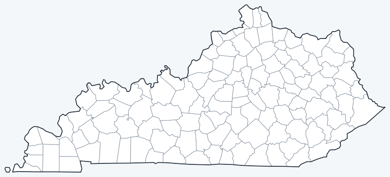
County lines are switched on when the interactive map loads. Hover over a county to see its name, or untick Show counties to hide the lines.
List of Kentucky counties
| County | County seat | Population (2020) | Land area (sq mi) |
|---|---|---|---|
| Adair | Columbia | 18,903 | 405.3 |
| Allen | Scottsville | 20,588 | 344.3 |
| Anderson | Lawrenceburg | 23,852 | 202.2 |
| Ballard | Wickliffe | 7,728 | 246.9 |
| Barren | Glasgow | 44,485 | 487.6 |
| Bath | Owingsville | 12,750 | 278.8 |
| Bell | Pineville | 24,097 | 359.1 |
| Boone | Burlington | 135,968 | 246.3 |
| Bourbon | Paris | 20,252 | 289.7 |
| Boyd | Catlettsburg | 48,261 | 159.9 |
| Boyle | Danville | 30,614 | 180.3 |
| Bracken | Brooksville | 8,400 | 202.7 |
| Breathitt | Jackson | 13,718 | 492.4 |
| Breckinridge | Hardinsburg | 20,432 | 569.8 |
| Bullitt | Shepherdsville | 82,217 | 297.1 |
| Butler | Morgantown | 12,371 | 426.1 |
| Caldwell | Princeton | 12,649 | 344.8 |
| Calloway | Murray | 37,103 | 385.0 |
| Campbell | Alexandria and Newport | 93,076 | 151.3 |
| Carlisle | Bardwell | 4,826 | 189.4 |
| Carroll | Carrollton | 10,810 | 128.7 |
| Carter | Grayson | 26,627 | 409.5 |
| Casey | Liberty | 15,941 | 444.2 |
| Christian | Hopkinsville | 72,748 | 717.5 |
| Clark | Winchester | 36,972 | 252.5 |
| Clay | Manchester | 20,345 | 469.3 |
| Clinton | Albany | 9,253 | 197.3 |
| Crittenden | Marion | 8,990 | 360.0 |
| Cumberland | Burkesville | 5,888 | 305.2 |
| Daviess | Owensboro | 103,312 | 458.4 |
| Edmonson | Brownsville | 12,126 | 302.9 |
| Elliott | Sandy Hook | 7,354 | 234.3 |
| Estill | Irvine | 14,163 | 253.1 |
| Fayette | Lexington | 322,570 | 283.6 |
| Fleming | Flemingsburg | 15,082 | 348.5 |
| Floyd | Prestonsburg | 35,942 | 393.3 |
| Franklin | Frankfort | 51,541 | 207.8 |
| Fulton | Hickman | 6,515 | 205.9 |
| Gallatin | Warsaw | 8,690 | 98.4 |
| Garrard | Lancaster | 16,953 | 230.1 |
| Grant | Williamstown | 24,941 | 258.0 |
| Graves | Mayfield | 36,649 | 551.8 |
| Grayson | Leitchfield | 26,420 | 499.9 |
| Green | Greensburg | 11,107 | 286.0 |
| Greenup | Greenup | 35,962 | 344.5 |
| Hancock | Hawesville | 9,095 | 187.7 |
| Hardin | Elizabethtown | 110,702 | 623.4 |
| Harlan | Harlan | 26,831 | 465.8 |
| Harrison | Cynthiana | 18,692 | 306.4 |
| Hart | Munfordville | 19,288 | 412.6 |
| Henderson | Henderson | 44,793 | 436.3 |
| Henry | New Castle | 15,678 | 286.3 |
| Hickman | Clinton | 4,521 | 242.3 |
| Hopkins | Madisonville | 45,423 | 542.1 |
| Jackson | McKee | 12,955 | 345.2 |
| Jefferson | Louisville | 782,969 | 380.8 |
| Jessamine | Nicholasville | 52,991 | 172.2 |
| Johnson | Paintsville | 22,680 | 262.0 |
| Kenton | Covington and Independence | 169,064 | 160.3 |
| Knott | Hindman | 14,251 | 351.5 |
| Knox | Barbourville | 30,193 | 386.3 |
| Larue | Hodgenville | 14,867 | 261.6 |
| Laurel | London | 62,613 | 434.0 |
| Lawrence | Louisa | 16,293 | 415.6 |
| Lee | Beattyville | 7,395 | 208.9 |
| Leslie | Hyden | 10,513 | 400.9 |
| Letcher | Whitesburg | 21,548 | 337.9 |
| Lewis | Vanceburg | 13,080 | 482.8 |
| Lincoln | Stanford | 24,275 | 332.8 |
| Livingston | Smithland | 8,888 | 313.3 |
| Logan | Russellville | 27,432 | 552.2 |
| Lyon | Eddyville | 8,680 | 213.8 |
| Madison | Richmond | 92,701 | 437.4 |
| Magoffin | Salyersville | 11,637 | 308.4 |
| Marion | Lebanon | 19,581 | 343.0 |
| Marshall | Benton | 31,659 | 302.2 |
| Martin | Inez | 11,287 | 229.6 |
| Mason | Maysville | 17,120 | 240.1 |
| McCracken | Paducah | 67,875 | 248.7 |
| McCreary | Whitley City | 16,888 | 426.8 |
| McLean | Calhoun | 9,152 | 252.5 |
| Meade | Brandenburg | 30,003 | 305.4 |
| Menifee | Frenchburg | 6,113 | 203.6 |
| Mercer | Harrodsburg | 22,641 | 249.1 |
| Metcalfe | Edmonton | 10,286 | 289.6 |
| Monroe | Tompkinsville | 11,338 | 329.4 |
| Montgomery | Mount Sterling | 28,114 | 197.4 |
| Morgan | West Liberty | 13,726 | 381.1 |
| Muhlenberg | Greenville | 30,928 | 467.4 |
| Nelson | Bardstown | 46,738 | 417.5 |
| Nicholas | Carlisle | 7,537 | 195.2 |
| Ohio | Hartford | 23,772 | 587.3 |
| Oldham | La Grange | 67,607 | 187.2 |
| Owen | Owenton | 11,278 | 351.1 |
| Owsley | Booneville | 4,051 | 197.4 |
| Pendleton | Falmouth | 14,644 | 277.2 |
| Perry | Hazard | 28,473 | 339.7 |
| Pike | Pikeville | 58,669 | 786.7 |
| Powell | Stanton | 13,129 | 179.0 |
| Pulaski | Somerset | 65,034 | 658.4 |
| Robertson | Mount Olivet | 2,193 | 99.9 |
| Rockcastle | Mount Vernon | 16,037 | 316.5 |
| Rowan | Morehead | 24,662 | 279.8 |
| Russell | Jamestown | 17,991 | 253.7 |
| Scott | Georgetown | 57,155 | 281.8 |
| Shelby | Shelbyville | 48,065 | 379.8 |
| Simpson | Franklin | 19,594 | 234.2 |
| Spencer | Taylorsville | 19,490 | 186.7 |
| Taylor | Campbellsville | 26,023 | 266.4 |
| Todd | Elkton | 12,243 | 374.5 |
| Trigg | Cadiz | 14,061 | 441.5 |
| Trimble | Bedford | 8,474 | 151.6 |
| Union | Morganfield | 13,668 | 342.8 |
| Warren | Bowling Green | 134,554 | 541.7 |
| Washington | Springfield | 12,027 | 297.0 |
| Wayne | Monticello | 19,555 | 458.2 |
| Webster | Dixon | 13,017 | 332.1 |
| Whitley | Williamsburg | 36,712 | 437.8 |
| Wolfe | Campton | 6,562 | 222.2 |
| Woodford | Versailles | 26,871 | 190.1 |
Most populous counties
Kentucky had 4,505,836 residents in the 2020 Census. The five most populous counties hold 34.3% of them:
- Jefferson County (seat: Louisville): 782,969 people, 17.4% of the state
- Fayette County (seat: Lexington): 322,570 people, 7.2% of the state
- Kenton County (seat: Covington and Independence): 169,064 people, 3.8% of the state
- Boone County (seat: Burlington): 135,968 people, 3.0% of the state
- Warren County (seat: Bowling Green): 134,554 people, 3.0% of the state
The least populous county is Robertson County, with 2,193 residents.
Largest and smallest counties
By land area, the largest counties are Pike County (786.7 sq mi), Christian County (717.5 sq mi) and Pulaski County (658.4 sq mi). The smallest are Gallatin County (98.4 sq mi), Robertson County (99.9 sq mi) and Carroll County (128.7 sq mi).
Pike County is also the largest counting water, at 788.6 sq mi in total. The average county covers 329.1 sq mi of land.
How counties work in Kentucky
Only Texas (254) and Georgia (159) have more counties than Kentucky. Many Kentucky counties are small: Gallatin County has just 98.4 sq mi of land.
Each county is governed by a fiscal court, led by an elected county judge/executive.
Kentucky’s two largest cities have merged with their counties. Lexington and Fayette County formed the Lexington-Fayette Urban County Government in 1974, and Louisville and Jefferson County merged into Louisville/Jefferson County Metro Government in 2003.
Two Northern Kentucky counties have two county seats each: Kenton County (Covington and Independence) and Campbell County (Alexandria and Newport).
Printable Kentucky county maps
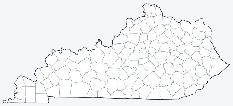
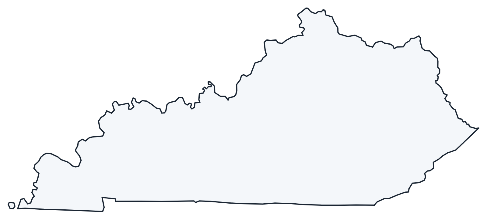
The labeled map shows every county name; the blank version has county lines only, for coloring or quizzes. Both are SVG files that print sharply at any size.
Frequently asked questions
How many counties are in Kentucky?
Kentucky has 120 counties, more than any state except Texas and Georgia.
What is the largest county in Kentucky?
Pike County, with 786.7 sq mi of land; its seat is Pikeville. Christian County (717.5 sq mi) is second.
What is the most populous county in Kentucky?
Jefferson County, with 782,969 people in 2020, or 17.4% of the state. Fayette County (Lexington) is second with 322,570.
What county is Louisville in?
Louisville is in Jefferson County; the city and county have had a merged metro government since 2003. Frankfort, the capital, is in Franklin County.
Neighboring state county maps
Illinois county map · Indiana county map · Missouri county map · Ohio county map · Tennessee county map · Virginia county map · West Virginia county map
Back to the Kentucky state map or browse all 50 state maps.
Sources: U.S. Census Bureau (2020 Census, 2020 Gazetteer, boundaries); county seats: Wikidata and Wikipedia county lists. Last reviewed October 2026.