Ohio County Map
Ohio has 88 counties. Franklin County, whose seat is Columbus, the state capital, is the most populous with 1,323,807 residents in 2020, and Ashtabula County is the largest by land area at 702.1 sq mi.
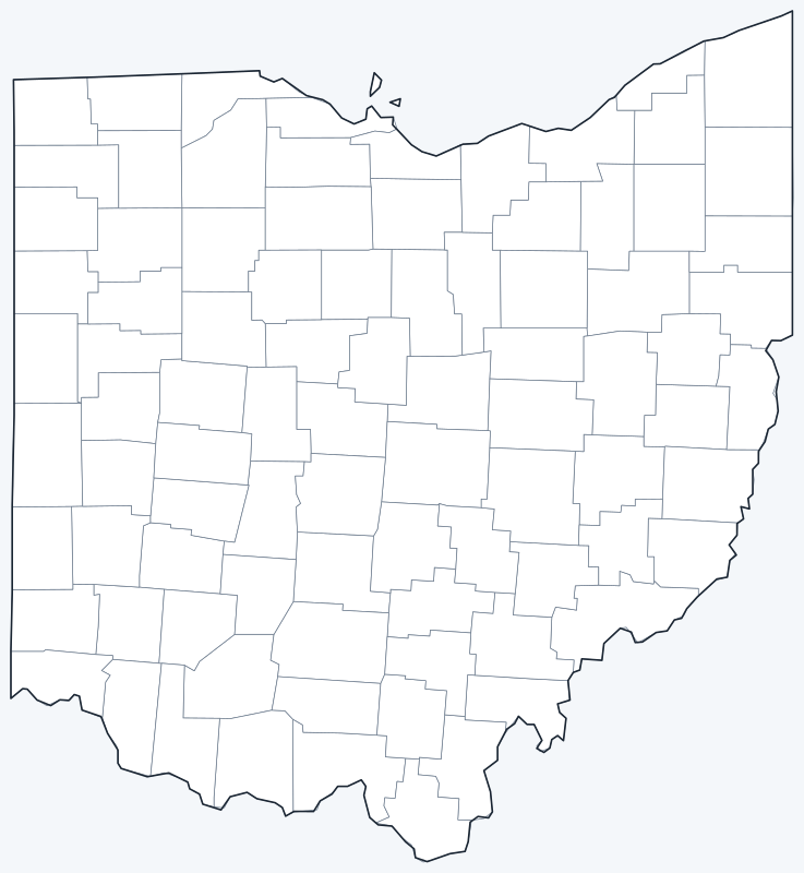
Counties are switched on when the interactive map loads. Hover over a county to see its name, or untick Show counties to hide the county lines.
List of Ohio counties
All 88 counties in alphabetical order. Click a column heading to sort by seat, population or land area.
| County | County seat | Population (2020) | Land area (sq mi) |
|---|---|---|---|
| Adams County | West Union | 27,477 | 583.9 |
| Allen County | Lima | 102,206 | 402.5 |
| Ashland County | Ashland | 52,447 | 423.0 |
| Ashtabula County | Jefferson | 97,574 | 702.1 |
| Athens County | Athens | 62,431 | 503.6 |
| Auglaize County | Wapakoneta | 46,422 | 401.4 |
| Belmont County | St. Clairsville | 66,497 | 532.1 |
| Brown County | Georgetown | 43,676 | 489.5 |
| Butler County | Hamilton | 390,357 | 466.5 |
| Carroll County | Carrollton | 26,721 | 394.6 |
| Champaign County | Urbana | 38,714 | 429.0 |
| Clark County | Springfield | 136,001 | 396.9 |
| Clermont County | Batavia | 208,601 | 452.6 |
| Clinton County | Wilmington | 42,018 | 408.7 |
| Columbiana County | Lisbon | 101,877 | 531.9 |
| Coshocton County | Coshocton | 36,612 | 564.0 |
| Crawford County | Bucyrus | 42,025 | 401.8 |
| Cuyahoga County | Cleveland | 1,264,817 | 457.2 |
| Darke County | Greenville | 51,881 | 598.1 |
| Defiance County | Defiance | 38,286 | 411.4 |
| Delaware County | Delaware | 214,124 | 443.1 |
| Erie County | Sandusky | 75,622 | 251.3 |
| Fairfield County | Lancaster | 158,921 | 504.4 |
| Fayette County | Washington Court House | 28,951 | 406.4 |
| Franklin County | Columbus | 1,323,807 | 532.4 |
| Fulton County | Wauseon | 42,713 | 405.4 |
| Gallia County | Gallipolis | 29,220 | 466.5 |
| Geauga County | Chardon | 95,397 | 400.3 |
| Greene County | Xenia | 167,966 | 413.6 |
| Guernsey County | Cambridge | 38,438 | 522.3 |
| Hamilton County | Cincinnati | 830,639 | 405.4 |
| Hancock County | Findlay | 74,920 | 531.3 |
| Hardin County | Kenton | 30,696 | 470.3 |
| Harrison County | Cadiz | 14,483 | 402.3 |
| Henry County | Napoleon | 27,662 | 416.0 |
| Highland County | Hillsboro | 43,317 | 553.1 |
| Hocking County | Logan | 28,050 | 421.3 |
| Holmes County | Millersburg | 44,223 | 422.6 |
| Huron County | Norwalk | 58,565 | 492.2 |
| Jackson County | Jackson | 32,653 | 420.3 |
| Jefferson County | Steubenville | 65,249 | 408.1 |
| Knox County | Mount Vernon | 62,721 | 525.5 |
| Lake County | Painesville | 232,603 | 229.3 |
| Lawrence County | Ironton | 58,240 | 453.4 |
| Licking County | Newark | 178,519 | 682.4 |
| Logan County | Bellefontaine | 46,150 | 458.5 |
| Lorain County | Elyria | 312,964 | 490.5 |
| Lucas County | Toledo | 431,279 | 339.7 |
| Madison County | London | 43,824 | 465.8 |
| Mahoning County | Youngstown | 228,614 | 411.5 |
| Marion County | Marion | 65,359 | 403.8 |
| Medina County | Medina | 182,470 | 421.5 |
| Meigs County | Pomeroy | 22,210 | 430.1 |
| Mercer County | Celina | 42,528 | 462.4 |
| Miami County | Troy | 108,774 | 406.5 |
| Monroe County | Woodsfield | 13,385 | 455.7 |
| Montgomery County | Dayton | 537,309 | 461.4 |
| Morgan County | McConnelsville | 13,802 | 416.4 |
| Morrow County | Mount Gilead | 34,950 | 406.1 |
| Muskingum County | Zanesville | 86,410 | 664.5 |
| Noble County | Caldwell | 14,115 | 398.0 |
| Ottawa County | Port Clinton | 40,364 | 254.7 |
| Paulding County | Paulding | 18,806 | 416.4 |
| Perry County | New Lexington | 35,408 | 407.9 |
| Pickaway County | Circleville | 58,539 | 501.2 |
| Pike County | Waverly | 27,088 | 440.3 |
| Portage County | Ravenna | 161,791 | 487.4 |
| Preble County | Eaton | 40,999 | 424.2 |
| Putnam County | Ottawa | 34,451 | 482.5 |
| Richland County | Mansfield | 124,936 | 495.2 |
| Ross County | Chillicothe | 77,093 | 689.2 |
| Sandusky County | Fremont | 58,896 | 408.2 |
| Scioto County | Portsmouth | 74,008 | 610.1 |
| Seneca County | Tiffin | 55,069 | 551.0 |
| Shelby County | Sidney | 48,230 | 407.7 |
| Stark County | Canton | 374,853 | 575.3 |
| Summit County | Akron | 540,428 | 412.8 |
| Trumbull County | Warren | 201,977 | 618.1 |
| Tuscarawas County | New Philadelphia | 93,263 | 567.4 |
| Union County | Marysville | 62,784 | 431.8 |
| Van Wert County | Van Wert | 28,931 | 409.1 |
| Vinton County | McArthur | 12,800 | 412.4 |
| Warren County | Lebanon | 242,337 | 401.4 |
| Washington County | Marietta | 59,771 | 632.0 |
| Wayne County | Wooster | 116,894 | 554.8 |
| Williams County | Bryan | 37,102 | 420.7 |
| Wood County | Bowling Green | 132,248 | 617.2 |
| Wyandot County | Upper Sandusky | 21,900 | 406.9 |
Most populous counties
The five largest counties by 2020 population hold 38.1% of Ohio’s 11,799,448 residents:
- Franklin County (seat: Columbus): 1,323,807 people, 11.2% of the state
- Cuyahoga County (seat: Cleveland): 1,264,817 people, 10.7% of the state
- Hamilton County (seat: Cincinnati): 830,639 people, 7.0% of the state
- Summit County (seat: Akron): 540,428 people, 4.6% of the state
- Montgomery County (seat: Dayton): 537,309 people, 4.6% of the state
The least populous county is Vinton County, with 12,800 people.
Largest and smallest counties
By land area, the largest counties are Ashtabula County (702.1 sq mi), Ross County (689.2 sq mi) and Licking County (682.4 sq mi). The smallest are Lake County (229.3 sq mi), Erie County (251.3 sq mi) and Ottawa County (254.7 sq mi). Areas exclude water.
How counties work in Ohio
All 88 counties have a county government and a county seat. Most are run by a three-member board of county commissioners; Summit County and Cuyahoga County have charter governments with an elected county executive.
Columbus is the seat of Franklin County, but parts of the city extend into Delaware and Fairfield counties. Counties on Lake Erie include large areas of water: Lake County, the smallest by land area (229.3 sq mi), covers 979.2 sq mi in total, and Ashtabula County covers 1,367.9 sq mi.
Printable Ohio county maps
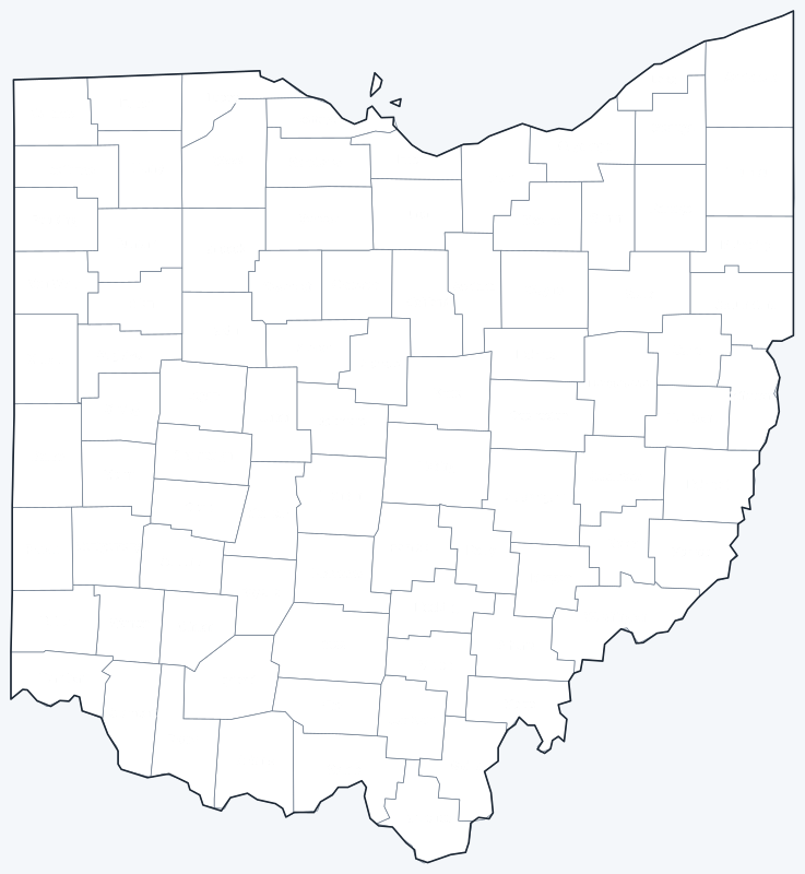
Download the labeled county map for reference or the blank version for coloring and geography practice; both are SVG files that print sharply at any size.
Frequently asked questions
How many counties are in Ohio?
88. The least populous is Vinton County, with 12,800 people in 2020.
What is the largest county in Ohio?
By land area, Ashtabula County in the northeast corner (702.1 sq mi), followed by Ross County (689.2 sq mi).
What is the most populous county in Ohio?
Franklin County, with 1,323,807 people in 2020, followed by Cuyahoga County (Cleveland) with 1,264,817.
What county is Columbus in?
Columbus is the seat of Franklin County; small parts of the city lie in Delaware and Fairfield counties.
More maps
Back to the Ohio state map. County maps of neighboring states: Indiana county map · Kentucky county map · Michigan county map · Pennsylvania county map · West Virginia county map.
Browse all 50 state maps.
Sources: U.S. Census Bureau (2020 Census, 2020 Gazetteer, boundaries); county seats: Wikipedia and Wikidata county lists. Last reviewed October 2026.