West Virginia County Map
West Virginia has 55 counties. Kanawha County is the most populous, with 180,745 people in 2020, and Randolph County is the largest by land area at 1,039.7 sq mi. The capital, Charleston, is the seat of Kanawha County.
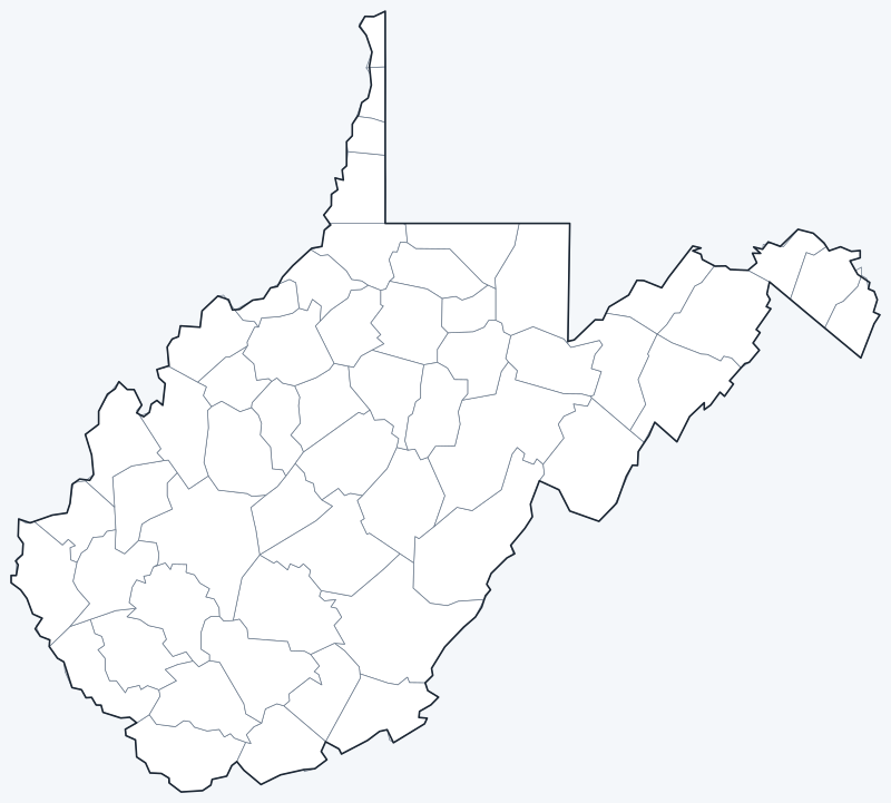
County lines are switched on when the interactive map loads. Hover over a county to see its name, or untick Show counties to hide the lines.
List of West Virginia counties
| County | County seat | Population (2020) | Land area (sq mi) |
|---|---|---|---|
| Barbour | Philippi | 15,465 | 341.1 |
| Berkeley | Martinsburg | 122,076 | 321.1 |
| Boone | Madison | 21,809 | 501.5 |
| Braxton | Sutton | 12,447 | 510.7 |
| Brooke | Wellsburg | 22,559 | 89.2 |
| Cabell | Huntington | 94,350 | 281.0 |
| Calhoun | Grantsville | 6,229 | 279.2 |
| Clay | Clay | 8,051 | 341.9 |
| Doddridge | West Union | 7,808 | 319.7 |
| Fayette | Fayetteville | 40,488 | 661.6 |
| Gilmer | Glenville | 7,408 | 338.5 |
| Grant | Petersburg | 10,976 | 477.4 |
| Greenbrier | Lewisburg | 32,977 | 1,019.8 |
| Hampshire | Romney | 23,093 | 640.4 |
| Hancock | New Cumberland | 29,095 | 82.6 |
| Hardy | Moorefield | 14,299 | 582.3 |
| Harrison | Clarksburg | 65,921 | 416.0 |
| Jackson | Ripley | 27,791 | 464.4 |
| Jefferson | Charles Town | 57,701 | 209.3 |
| Kanawha | Charleston | 180,745 | 901.6 |
| Lewis | Weston | 17,033 | 386.9 |
| Lincoln | Hamlin | 20,463 | 437.1 |
| Logan | Logan | 32,567 | 453.7 |
| Marion | Fairmont | 56,205 | 308.8 |
| Marshall | Moundsville | 30,591 | 305.4 |
| Mason | Point Pleasant | 25,453 | 430.8 |
| McDowell | Welch | 19,111 | 533.5 |
| Mercer | Princeton | 59,664 | 419.0 |
| Mineral | Keyser | 26,938 | 327.9 |
| Mingo | Williamson | 23,568 | 423.1 |
| Monongalia | Morgantown | 105,822 | 360.1 |
| Monroe | Union | 12,376 | 472.8 |
| Morgan | Berkeley Springs | 17,063 | 229.1 |
| Nicholas | Summersville | 24,604 | 646.8 |
| Ohio | Wheeling | 42,425 | 105.8 |
| Pendleton | Franklin | 6,143 | 696.0 |
| Pleasants | St. Marys | 7,653 | 130.1 |
| Pocahontas | Marlinton | 7,869 | 940.2 |
| Preston | Kingwood | 34,216 | 648.8 |
| Putnam | Winfield | 57,440 | 345.7 |
| Raleigh | Beckley | 74,591 | 605.4 |
| Randolph | Elkins | 27,932 | 1,039.7 |
| Ritchie | Harrisville | 8,444 | 452.0 |
| Roane | Spencer | 14,028 | 483.6 |
| Summers | Hinton | 11,959 | 360.6 |
| Taylor | Grafton | 16,705 | 172.8 |
| Tucker | Parsons | 6,762 | 419.0 |
| Tyler | Middlebourne | 8,313 | 256.3 |
| Upshur | Buckhannon | 23,816 | 354.6 |
| Wayne | Wayne | 38,982 | 506.0 |
| Webster | Webster Springs | 8,378 | 553.5 |
| Wetzel | New Martinsville | 14,442 | 358.1 |
| Wirt | Elizabeth | 5,194 | 232.5 |
| Wood | Parkersburg | 84,296 | 366.5 |
| Wyoming | Pineville | 21,382 | 499.5 |
Most populous counties
The five most populous counties had 587,289 residents in 2020, 32.7% of West Virginia’s 1,793,716 people.
- Kanawha County: 180,745 (10.1% of the state), seat Charleston
- Berkeley County: 122,076 (6.8% of the state), seat Martinsburg
- Monongalia County: 105,822 (5.9% of the state), seat Morgantown
- Cabell County: 94,350 (5.3% of the state), seat Huntington
- Wood County: 84,296 (4.7% of the state), seat Parkersburg
The least populous is Wirt County, with 5,194 residents. Of the 55 counties, 12 had fewer than 10,000 people in 2020.
Largest and smallest counties
By land area, the largest counties are Randolph (1,039.7 sq mi), Greenbrier (1,019.8 sq mi) and Pocahontas (940.2 sq mi). The smallest is Hancock County at 82.6 sq mi, followed by Brooke (89.2 sq mi) and Ohio (105.8 sq mi).
The average West Virginia county covers 437.1 sq mi of land. The most densely populated is Ohio County, with about 401 people per sq mi; the least dense is Pocahontas County, with about 8.4.
How counties work in West Virginia
West Virginia was formed in 1863 from 50 counties that split from Virginia during the Civil War; the remaining counties were created later from parts of existing ones, bringing the total to 55. The state has no independent cities, so every city and town lies inside a county.
Each county is governed by an elected county commission and has a county seat, listed in the table above, where the county courthouse stands.
Printable West Virginia county maps
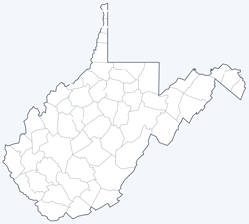
The labeled map shows every county name; the blank version has county lines only, for coloring, quizzes or school projects. Free for personal and classroom use.
Frequently asked questions
How many counties are in West Virginia?
West Virginia has 55 counties, each with its own county seat (see the table above).
What is the largest county in West Virginia?
Randolph County, with 1,039.7 sq mi of land. Its seat is Elkins.
What is the most populous county in West Virginia?
Kanawha County, with 180,745 residents in the 2020 Census. Its seat is Charleston.
What county is Charleston, West Virginia, in?
Charleston, the state capital and largest city, is in Kanawha County and is its county seat.
Neighboring state county maps
Pennsylvania · Maryland · Virginia · Kentucky · Ohio
Back to the West Virginia state map or browse all 50 state maps.
Sources: U.S. Census Bureau (2020 Census, 2020 Gazetteer, boundaries); county seats from Wikipedia county lists cross-checked with Wikidata. Last reviewed October 2026.