Virginia County Map
Virginia is divided into 95 counties and 38 independent cities, which the Census Bureau counts as 133 county equivalents. Fairfax County is the most populous (1,150,309 people in 2020), Pittsylvania County is the largest by land area (969.0 sq mi), and the capital, Richmond, is an independent city that belongs to no county.
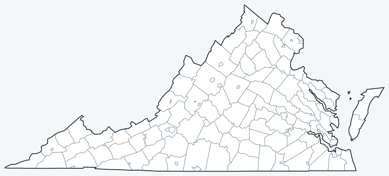
County lines are switched on when the interactive map loads. Hover over a county or independent city to see its name, or untick Show counties to hide the lines.
List of Virginia counties
| County | County seat | Population (2020) | Land area (sq mi) |
|---|---|---|---|
| Accomack | Accomac | 33,413 | 449.3 |
| Albemarle | Charlottesville | 112,395 | 720.5 |
| Alleghany | Covington | 15,223 | 446.6 |
| Amelia | Amelia Court House | 13,265 | 355.4 |
| Amherst | Amherst | 31,307 | 474.0 |
| Appomattox | Appomattox | 16,119 | 334.2 |
| Arlington | Arlington | 238,643 | 26.0 |
| Augusta | Staunton | 77,487 | 967.1 |
| Bath | Warm Springs | 4,209 | 529.2 |
| Bedford | Bedford | 79,462 | 760.1 |
| Bland | Bland | 6,270 | 357.7 |
| Botetourt | Fincastle | 33,596 | 541.3 |
| Brunswick | Lawrenceville | 15,849 | 566.2 |
| Buchanan | Grundy | 20,355 | 502.9 |
| Buckingham | Buckingham | 16,824 | 579.6 |
| Campbell | Rustburg | 55,696 | 503.2 |
| Caroline | Bowling Green | 30,887 | 527.4 |
| Carroll | Hillsville | 29,155 | 474.7 |
| Charles City | Charles City | 6,773 | 182.9 |
| Charlotte | Charlotte Court House | 11,529 | 475.3 |
| Chesterfield | Chesterfield Court House | 364,548 | 423.5 |
| Clarke | Berryville | 14,783 | 175.9 |
| Craig | New Castle | 4,892 | 328.1 |
| Culpeper | Culpeper | 52,552 | 379.2 |
| Cumberland | Cumberland | 9,675 | 297.5 |
| Dickenson | Clintwood | 14,124 | 330.5 |
| Dinwiddie | Dinwiddie | 27,947 | 503.9 |
| Essex | Tappahannock | 10,599 | 257.3 |
| Fairfax | Fairfax | 1,150,309 | 391.0 |
| Fauquier | Warrenton | 72,972 | 648.0 |
| Floyd | Floyd | 15,476 | 380.9 |
| Fluvanna | Palmyra | 27,249 | 287.1 |
| Franklin | Rocky Mount | 54,477 | 690.6 |
| Frederick | Winchester | 91,419 | 413.1 |
| Giles | Pearisburg | 16,787 | 357.2 |
| Gloucester | Gloucester Courthouse | 38,711 | 217.8 |
| Goochland | Goochland | 24,727 | 282.0 |
| Grayson | Independence | 15,333 | 441.8 |
| Greene | Stanardsville | 20,552 | 155.9 |
| Greensville | Emporia | 11,391 | 295.2 |
| Halifax | Halifax | 34,022 | 817.7 |
| Hanover | Hanover Courthouse | 109,979 | 467.6 |
| Henrico | — | 334,389 | 233.7 |
| Henry | Martinsville | 50,948 | 382.4 |
| Highland | Monterey | 2,232 | 415.2 |
| Isle of Wight | Isle of Wight | 38,606 | 315.7 |
| James City | Williamsburg | 78,254 | 142.3 |
| King George | King George | 26,723 | 179.6 |
| King William | King William | 17,810 | 273.9 |
| King and Queen | King and Queen Court House | 6,608 | 315.1 |
| Lancaster | Lancaster | 10,919 | 133.3 |
| Lee | Jonesville | 22,173 | 435.4 |
| Loudoun | Leesburg | 420,959 | 515.7 |
| Louisa | Louisa | 37,596 | 495.0 |
| Lunenburg | Lunenburg | 11,936 | 431.7 |
| Madison | Madison | 13,837 | 320.6 |
| Mathews | Mathews | 8,533 | 85.9 |
| Mecklenburg | Boydton | 30,319 | 625.3 |
| Middlesex | Saluda | 10,625 | 130.3 |
| Montgomery | Christiansburg | 99,721 | 386.8 |
| Nelson | Lovingston | 14,775 | 470.7 |
| New Kent | New Kent | 22,945 | 210.0 |
| Northampton | Eastville | 12,282 | 211.7 |
| Northumberland | Heathsville | 11,839 | 191.4 |
| Nottoway | Nottoway | 15,642 | 314.4 |
| Orange | Orange | 36,254 | 341.1 |
| Page | Luray | 23,709 | 310.0 |
| Patrick | Stuart | 17,608 | 483.0 |
| Pittsylvania | Chatham | 60,501 | 969.0 |
| Powhatan | Powhatan | 30,333 | 260.2 |
| Prince Edward | Farmville | 21,849 | 349.9 |
| Prince George | Prince George | 43,010 | 265.3 |
| Prince William | Manassas | 482,204 | 335.3 |
| Pulaski | Pulaski | 33,800 | 319.8 |
| Rappahannock | Washington | 7,348 | 266.4 |
| Richmond | Warsaw | 8,923 | 191.5 |
| Roanoke | Salem | 96,929 | 250.5 |
| Rockbridge | Lexington | 22,650 | 596.5 |
| Rockingham | Harrisonburg | 83,757 | 849.8 |
| Russell | Lebanon | 25,781 | 473.5 |
| Scott | Gate City | 21,576 | 535.8 |
| Shenandoah | Woodstock | 44,186 | 508.1 |
| Smyth | Marion | 29,800 | 451.4 |
| Southampton | Courtland | 17,996 | 599.2 |
| Spotsylvania | Spotsylvania Courthouse | 140,032 | 401.4 |
| Stafford | Stafford | 156,927 | 269.2 |
| Surry | Surry | 6,561 | 278.9 |
| Sussex | Sussex | 10,829 | 490.2 |
| Tazewell | Tazewell | 40,429 | 518.8 |
| Warren | Front Royal | 40,727 | 214.6 |
| Washington | Abingdon | 53,935 | 561.2 |
| Westmoreland | Montross | 18,477 | 229.3 |
| Wise | Wise | 36,130 | 403.4 |
| Wythe | Wytheville | 28,290 | 462.0 |
| York | Yorktown | 70,045 | 104.7 |
Henrico County’s seat is left blank (—) because our sources disagree on it. Several county seats, such as Fairfax and Manassas, are independent cities located outside the county they serve.
Independent cities of Virginia
| Independent city | Population (2020) | Land area (sq mi) |
|---|---|---|
| Alexandria | 159,467 | 14.9 |
| Bristol | 17,219 | 12.9 |
| Buena Vista | 6,641 | 6.4 |
| Charlottesville | 46,553 | 10.2 |
| Chesapeake | 249,422 | 338.5 |
| Colonial Heights | 18,170 | 7.5 |
| Covington | 5,737 | 5.5 |
| Danville | 42,590 | 42.8 |
| Emporia | 5,766 | 6.9 |
| Fairfax | 24,146 | 6.2 |
| Falls Church | 14,658 | 2.0 |
| Franklin | 8,180 | 8.3 |
| Fredericksburg | 27,982 | 10.5 |
| Galax | 6,720 | 8.2 |
| Hampton | 137,148 | 51.5 |
| Harrisonburg | 51,814 | 17.3 |
| Hopewell | 23,033 | 10.4 |
| Lexington | 7,320 | 2.5 |
| Lynchburg | 79,009 | 49.0 |
| Manassas | 42,772 | 9.8 |
| Manassas Park | 17,219 | 3.0 |
| Martinsville | 13,485 | 11.0 |
| Newport News | 186,247 | 69.0 |
| Norfolk | 238,005 | 53.3 |
| Norton | 3,687 | 7.5 |
| Petersburg | 33,458 | 22.7 |
| Poquoson | 12,460 | 15.4 |
| Portsmouth | 97,915 | 33.3 |
| Radford | 16,070 | 9.7 |
| Richmond | 226,610 | 59.9 |
| Roanoke | 100,011 | 42.5 |
| Salem | 25,346 | 14.5 |
| Staunton | 25,750 | 19.9 |
| Suffolk | 94,324 | 399.2 |
| Virginia Beach | 459,470 | 244.7 |
| Waynesboro | 22,196 | 15.0 |
| Williamsburg | 15,425 | 8.9 |
| Winchester | 28,120 | 9.2 |
Most populous counties
The five most populous counties had 2,752,409 residents in 2020, 31.9% of Virginia’s 8,631,393 people.
- Fairfax County: 1,150,309 (13.3% of the state), seat Fairfax
- Prince William County: 482,204 (5.6% of the state), seat Manassas
- Loudoun County: 420,959 (4.9% of the state), seat Leesburg
- Chesterfield County: 364,548 (4.2% of the state), seat Chesterfield Court House
- Henrico County: 334,389 (3.9% of the state)
The least populous is Highland County, with 2,232 residents. Of the 95 counties, 11 had fewer than 10,000 people in 2020.
Counted separately, the largest independent city is Virginia Beach (459,470, 5.3% of the state), followed by Chesapeake (249,422) and Norfolk (238,005). Together the 38 independent cities had 2,590,145 residents, 30.0% of Virginia’s population.
Largest and smallest counties
By land area, the largest counties are Pittsylvania (969.0 sq mi), Augusta (967.1 sq mi) and Rockingham (849.8 sq mi). The smallest is Arlington County at 26.0 sq mi, followed by Mathews (85.9 sq mi) and York (104.7 sq mi).
Among independent cities, Suffolk covers 399.2 sq mi of land, more than many counties, while Falls Church covers only 2.0 sq mi, the smallest county equivalent in Virginia.
Counties and independent cities in Virginia
Every incorporated city in Virginia is independent: it is not part of any county and runs its own local services. Towns, by contrast, stay inside their county. For this reason the Census Bureau and most data sets list Virginia’s independent cities alongside its counties as county equivalents.
Some names appear twice. Fairfax, Franklin, Richmond and Roanoke are each both a county and a separate independent city; Richmond County, for example, is on the Northern Neck, far from the city of Richmond. In all, 12 counties have their seat in an independent city outside the county’s own borders, such as Fairfax County, whose seat is the independent City of Fairfax (24,146 people).
The list changes occasionally: Bedford gave up its city status in 2013 and became a town within Bedford County.
Printable Virginia county maps
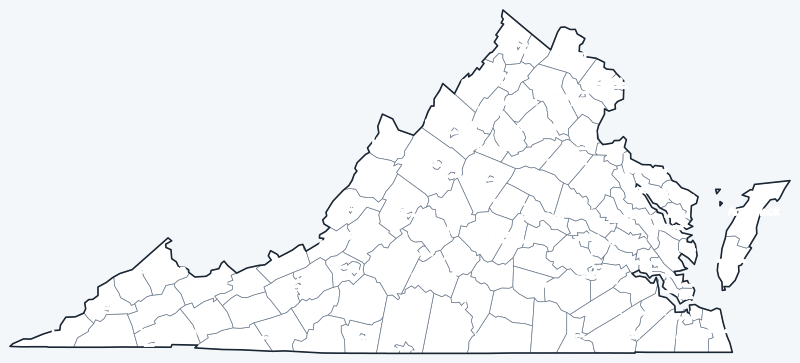
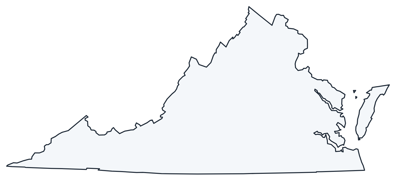
The labeled map shows every county and independent city name; the blank version has county lines only, for coloring, quizzes or school projects. Free for personal and classroom use.
Frequently asked questions
How many counties are in Virginia?
Virginia has 95 counties and 38 independent cities, for 133 county-level jurisdictions in all.
What is the largest county in Virginia?
Pittsylvania County, with 969.0 sq mi of land. Its seat is Chatham.
What is the most populous county in Virginia?
Fairfax County, with 1,150,309 residents in 2020. The most populous independent city is Virginia Beach (459,470).
What county is Richmond, Virginia, in?
None. Richmond is an independent city and is not part of any county. It borders Henrico and Chesterfield counties.
Neighboring state county maps
Maryland · West Virginia · Kentucky · Tennessee · North Carolina
Back to the Virginia state map or browse all 50 state maps.
Sources: U.S. Census Bureau (2020 Census, 2020 Gazetteer, boundaries); county seats from Wikipedia county lists cross-checked with Wikidata. Last reviewed October 2026.