North Carolina County Map
North Carolina has 100 counties. Wake County, whose seat is Raleigh, the state capital, is the most populous with 1,129,410 residents in 2020, just ahead of Mecklenburg County (Charlotte). Robeson County is the largest by land area at 947.3 sq mi.
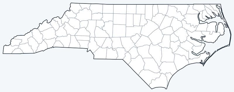
Counties are switched on when the interactive map loads. Hover over a county to see its name, or untick Show counties to hide the county lines.
List of North Carolina counties
All 100 counties in alphabetical order. Click a column heading to sort by seat, population or land area.
| County | County seat | Population (2020) | Land area (sq mi) |
|---|---|---|---|
| Alamance County | Graham | 171,415 | 423.5 |
| Alexander County | Taylorsville | 36,444 | 260.0 |
| Alleghany County | Sparta | 10,888 | 234.8 |
| Anson County | Wadesboro | 22,055 | 531.5 |
| Ashe County | Jefferson | 26,577 | 426.3 |
| Avery County | Newland | 17,806 | 247.3 |
| Beaufort County | Washington | 44,652 | 832.7 |
| Bertie County | Windsor | 17,934 | 699.2 |
| Bladen County | Elizabethtown | 29,606 | 875.0 |
| Brunswick County | Bolivia | 136,693 | 850.1 |
| Buncombe County | Asheville | 269,452 | 656.5 |
| Burke County | Morganton | 87,570 | 506.2 |
| Cabarrus County | Concord | 225,804 | 361.2 |
| Caldwell County | Lenoir | 80,652 | 471.9 |
| Camden County | Camden | 10,355 | 240.3 |
| Carteret County | Beaufort | 67,686 | 507.6 |
| Caswell County | Yanceyville | 22,736 | 425.4 |
| Catawba County | Newton | 160,610 | 401.4 |
| Chatham County | Pittsboro | 76,285 | 681.7 |
| Cherokee County | Murphy | 28,774 | 455.5 |
| Chowan County | Edenton | 13,708 | 172.7 |
| Clay County | Hayesville | 11,089 | 215.0 |
| Cleveland County | Shelby | 99,519 | 464.2 |
| Columbus County | Whiteville | 50,623 | 938.1 |
| Craven County | New Bern | 100,720 | 706.6 |
| Cumberland County | Fayetteville | 334,728 | 652.6 |
| Currituck County | Currituck | 28,100 | 261.9 |
| Dare County | Manteo | 36,915 | 383.2 |
| Davidson County | Lexington | 168,930 | 553.2 |
| Davie County | Mocksville | 42,712 | 263.7 |
| Duplin County | Kenansville | 48,715 | 814.7 |
| Durham County | Durham | 324,833 | 286.5 |
| Edgecombe County | Tarboro | 48,900 | 505.4 |
| Forsyth County | Winston-Salem | 382,590 | 407.9 |
| Franklin County | Louisburg | 68,573 | 491.8 |
| Gaston County | Gastonia | 227,943 | 355.8 |
| Gates County | Gatesville | 10,478 | 340.6 |
| Graham County | Robbinsville | 8,030 | 292.0 |
| Granville County | Oxford | 60,992 | 532.0 |
| Greene County | Snow Hill | 20,451 | 266.7 |
| Guilford County | Greensboro | 541,299 | 645.9 |
| Halifax County | Halifax | 48,622 | 723.7 |
| Harnett County | Lillington | 133,568 | 594.9 |
| Haywood County | Waynesville | 62,089 | 553.6 |
| Henderson County | Hendersonville | 116,281 | 372.9 |
| Hertford County | Winton | 21,552 | 353.2 |
| Hoke County | Raeford | 52,082 | 390.2 |
| Hyde County | Swan Quarter | 4,589 | 612.3 |
| Iredell County | Statesville | 186,693 | 574.4 |
| Jackson County | Sylva | 43,109 | 491.1 |
| Johnston County | Smithfield | 215,999 | 792.0 |
| Jones County | Trenton | 9,172 | 471.4 |
| Lee County | Sanford | 63,285 | 255.1 |
| Lenoir County | Kinston | 55,122 | 399.1 |
| Lincoln County | Lincolnton | 86,810 | 295.8 |
| Macon County | Franklin | 37,014 | 515.6 |
| Madison County | Marshall | 21,193 | 449.6 |
| Martin County | Williamston | 22,031 | 456.4 |
| McDowell County | Marion | 44,578 | 440.0 |
| Mecklenburg County | Charlotte | 1,115,482 | 523.6 |
| Mitchell County | Bakersville | 14,903 | 221.3 |
| Montgomery County | Troy | 25,751 | 491.5 |
| Moore County | Carthage | 99,727 | 697.7 |
| Nash County | Nashville | 94,970 | 540.4 |
| New Hanover County | Wilmington | 225,702 | 192.3 |
| Northampton County | Jackson | 17,471 | 536.7 |
| Onslow County | Jacksonville | 204,576 | 762.1 |
| Orange County | Hillsborough | 148,696 | 397.6 |
| Pamlico County | Bayboro | 12,276 | 336.5 |
| Pasquotank County | Elizabeth City | 40,568 | 226.9 |
| Pender County | Burgaw | 60,203 | 871.3 |
| Perquimans County | Hertford | 13,005 | 247.2 |
| Person County | Roxboro | 39,097 | 392.3 |
| Pitt County | Greenville | 170,243 | 652.4 |
| Polk County | Columbus | 19,328 | 237.7 |
| Randolph County | Asheboro | 144,171 | 782.3 |
| Richmond County | Rockingham | 42,946 | 473.7 |
| Robeson County | Lumberton | 116,530 | 947.3 |
| Rockingham County | Wentworth | 91,096 | 565.6 |
| Rowan County | Salisbury | 146,875 | 511.6 |
| Rutherford County | Rutherfordton | 64,444 | 565.4 |
| Sampson County | Clinton | 59,036 | 945.9 |
| Scotland County | Laurinburg | 34,174 | 319.1 |
| Stanly County | Albemarle | 62,504 | 395.1 |
| Stokes County | Danbury | 44,520 | 449.3 |
| Surry County | Dobson | 71,359 | 532.6 |
| Swain County | Bryson City | 14,117 | 527.7 |
| Transylvania County | Brevard | 32,986 | 378.4 |
| Tyrrell County | Columbia | 3,245 | 390.8 |
| Union County | Monroe | 238,267 | 632.7 |
| Vance County | Henderson | 42,578 | 252.4 |
| Wake County | Raleigh | 1,129,410 | 834.6 |
| Warren County | Warrenton | 18,642 | 429.4 |
| Washington County | Plymouth | 11,003 | 346.5 |
| Watauga County | Boone | 54,086 | 312.4 |
| Wayne County | Goldsboro | 117,333 | 553.9 |
| Wilkes County | Wilkesboro | 65,969 | 753.7 |
| Wilson County | Wilson | 78,784 | 367.6 |
| Yadkin County | Yadkinville | 37,214 | 334.9 |
| Yancey County | Burnsville | 18,470 | 312.6 |
Most populous counties
The five largest counties by 2020 population hold 33.6% of North Carolina’s 10,439,388 residents:
- Wake County (seat: Raleigh): 1,129,410 people, 10.8% of the state
- Mecklenburg County (seat: Charlotte): 1,115,482 people, 10.7% of the state
- Guilford County (seat: Greensboro): 541,299 people, 5.2% of the state
- Forsyth County (seat: Winston-Salem): 382,590 people, 3.7% of the state
- Cumberland County (seat: Fayetteville): 334,728 people, 3.2% of the state
The least populous county is Tyrrell County, with 3,245 people.
Largest and smallest counties
By land area, the largest counties are Robeson County (947.3 sq mi), Sampson County (945.9 sq mi) and Columbus County (938.1 sq mi). The smallest are Chowan County (172.7 sq mi), New Hanover County (192.3 sq mi) and Clay County (215.0 sq mi). Areas exclude water.
How counties work in North Carolina
All 100 counties have a county government, led by an elected board of county commissioners, and a county seat. In the 2020 Census, Wake County passed Mecklenburg County by 13,928 people; the two counties together hold 21.5% of the state’s population.
Land area and total area differ most on the coast. Dare County, which includes much of the Outer Banks, has 383.2 sq mi of land but 1,541.7 sq mi in total once sounds and ocean waters are counted.
Printable North Carolina county maps
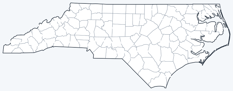
Download the labeled county map for reference or the blank version for coloring and geography practice; both are SVG files that print sharply at any size.
Frequently asked questions
How many counties are in North Carolina?
100. The least populous is Tyrrell County, with 3,245 people in 2020.
What is the largest county in North Carolina?
By land area, Robeson County (947.3 sq mi), narrowly ahead of Sampson County (945.9 sq mi). By total area including water, it is Dare County.
What is the most populous county in North Carolina?
Wake County, with 1,129,410 people in 2020, followed by Mecklenburg County with 1,115,482.
What county is Charlotte in?
Charlotte, the largest city, is the seat of Mecklenburg County. Raleigh, the capital, is the seat of Wake County.
More maps
Back to the North Carolina state map. County maps of neighboring states: Virginia county map · Tennessee county map · Georgia county map · South Carolina county map.
Browse all 50 state maps.
Sources: U.S. Census Bureau (2020 Census, 2020 Gazetteer, boundaries); county seats: Wikipedia and Wikidata county lists. Last reviewed October 2026.