Tennessee County Map
Tennessee has 95 counties. Shelby County is both the most populous, with 929,744 residents in 2020, and the largest by land area, at 760.6 sq mi. Nashville, the capital and largest city, is the county seat of Davidson County.
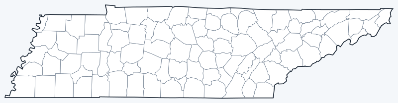
County lines are switched on when the interactive map loads; hover over a county to see its name. Untick Show counties to hide them.
List of Tennessee counties
| County | County seat | Population (2020) | Land area (sq mi) |
|---|---|---|---|
| Anderson | Clinton | 77,123 | 337.2 |
| Bedford | Shelbyville | 50,237 | 473.6 |
| Benton | Camden | 15,864 | 394.3 |
| Bledsoe | Pikeville | 14,913 | 406.6 |
| Blount | Maryville | 135,280 | 558.8 |
| Bradley | Cleveland | 108,620 | 328.8 |
| Campbell | Jacksboro | 39,272 | 480.2 |
| Cannon | Woodbury | 14,506 | 265.6 |
| Carroll | Huntingdon | 28,440 | 597.7 |
| Carter | Elizabethton | 56,356 | 341.3 |
| Cheatham | Ashland City | 41,072 | 302.5 |
| Chester | Henderson | 17,341 | 285.7 |
| Claiborne | Tazewell | 32,043 | 434.6 |
| Clay | Celina | 7,581 | 236.5 |
| Cocke | Newport | 35,999 | 436.1 |
| Coffee | Manchester | 57,889 | 429.0 |
| Crockett | Alamo | 13,911 | 265.5 |
| Cumberland | Crossville | 61,145 | 681.3 |
| Davidson | Nashville | 715,884 | 503.7 |
| DeKalb | Smithville | 20,080 | 304.4 |
| Decatur | Decaturville | 11,435 | 333.9 |
| Dickson | Charlotte | 54,315 | 489.9 |
| Dyer | Dyersburg | 36,801 | 512.4 |
| Fayette | Somerville | 41,990 | 704.8 |
| Fentress | Jamestown | 18,489 | 498.6 |
| Franklin | Winchester | 42,774 | 554.5 |
| Gibson | Trenton | 50,429 | 602.7 |
| Giles | Pulaski | 30,346 | 610.9 |
| Grainger | Rutledge | 23,527 | 280.6 |
| Greene | Greeneville | 70,152 | 622.2 |
| Grundy | Altamont | 13,529 | 360.4 |
| Hamblen | Morristown | 64,499 | 161.2 |
| Hamilton | Chattanooga | 366,207 | 542.2 |
| Hancock | Sneedville | 6,662 | 222.3 |
| Hardeman | Bolivar | 25,462 | 667.8 |
| Hardin | Savannah | 26,831 | 577.5 |
| Hawkins | Rogersville | 56,721 | 487.1 |
| Haywood | Brownsville | 17,864 | 533.1 |
| Henderson | Lexington | 27,842 | 520.0 |
| Henry | Paris | 32,199 | 561.9 |
| Hickman | Centerville | 24,925 | 612.5 |
| Houston | Erin | 8,283 | 200.3 |
| Humphreys | Waverly | 18,990 | 530.8 |
| Jackson | Gainesboro | 11,617 | 308.8 |
| Jefferson | Dandridge | 54,683 | 275.1 |
| Johnson | Mountain City | 17,948 | 298.4 |
| Knox | Knoxville | 478,971 | 508.3 |
| Lake | Tiptonville | 7,005 | 165.8 |
| Lauderdale | Ripley | 25,143 | 471.9 |
| Lawrence | Lawrenceburg | 44,159 | 617.1 |
| Lewis | Hohenwald | 12,582 | 282.1 |
| Lincoln | Fayetteville | 35,319 | 570.3 |
| Loudon | Loudon | 54,886 | 229.3 |
| Macon | Lafayette | 25,216 | 307.1 |
| Madison | Jackson | 98,823 | 557.2 |
| Marion | Jasper | 28,837 | 498.3 |
| Marshall | Lewisburg | 34,318 | 375.5 |
| Maury | Columbia | 100,974 | 613.1 |
| McMinn | Athens | 53,276 | 430.1 |
| McNairy | Selmer | 25,866 | 562.8 |
| Meigs | Decatur | 12,758 | 195.1 |
| Monroe | Madisonville | 46,250 | 635.8 |
| Montgomery | Clarksville | 220,069 | 539.2 |
| Moore | Lynchburg | 6,461 | 129.2 |
| Morgan | Wartburg | 21,035 | 522.2 |
| Obion | Union City | 30,787 | 544.8 |
| Overton | Livingston | 22,511 | 433.5 |
| Perry | Linden | 8,366 | 414.8 |
| Pickett | Byrdstown | 5,001 | 163.0 |
| Polk | Benton | 17,544 | 434.6 |
| Putnam | Cookeville | 79,854 | 401.1 |
| Rhea | Dayton | 32,870 | 315.5 |
| Roane | Kingston | 53,404 | 360.8 |
| Robertson | Springfield | 72,803 | 476.3 |
| Rutherford | Murfreesboro | 341,486 | 619.3 |
| Scott | Huntsville | 21,850 | 532.3 |
| Sequatchie | Dunlap | 15,826 | 265.9 |
| Sevier | Sevierville | 98,380 | 592.5 |
| Shelby | Memphis | 929,744 | 760.6 |
| Smith | Carthage | 19,904 | 314.3 |
| Stewart | Dover | 13,657 | 459.8 |
| Sullivan | Blountville | 158,163 | 413.4 |
| Sumner | Gallatin | 196,281 | 529.5 |
| Tipton | Covington | 60,970 | 455.6 |
| Trousdale | Hartsville | 11,615 | 114.3 |
| Unicoi | Erwin | 17,928 | 186.1 |
| Union | Maynardville | 19,802 | 223.6 |
| Van Buren | Spencer | 6,168 | 273.4 |
| Warren | McMinnville | 40,953 | 432.7 |
| Washington | Jonesborough | 133,001 | 326.5 |
| Wayne | Waynesboro | 16,232 | 734.1 |
| Weakley | Dresden | 32,902 | 580.4 |
| White | Sparta | 27,351 | 376.7 |
| Williamson | Franklin | 247,726 | 582.9 |
| Wilson | Lebanon | 147,737 | 570.9 |
Most populous counties
Tennessee had 6,910,840 residents in the 2020 Census. The five most populous counties hold 41.0% of them:
- Shelby County (seat: Memphis): 929,744 (13.5% of the state)
- Davidson County (seat: Nashville): 715,884 (10.4% of the state)
- Knox County (seat: Knoxville): 478,971 (6.9% of the state)
- Hamilton County (seat: Chattanooga): 366,207 (5.3% of the state)
- Rutherford County (seat: Murfreesboro): 341,486 (4.9% of the state)
At the other end, the least populous counties are Pickett County (5,001), Van Buren County (6,168) and Moore County (6,461).
Largest and smallest counties
Tennessee’s 95 counties cover 41,232.9 sq mi of land, an average of 434.0 sq mi each. The largest by land area are Shelby County (760.6 sq mi), Wayne County (734.1 sq mi) and Fayette County (704.8 sq mi).
The smallest is Trousdale County, with 114.3 sq mi of land, followed by Moore County (129.2 sq mi) and Hamblen County (161.2 sq mi). Shelby County is about 7 times the size of Trousdale County.
How counties work in Tennessee
Tennessee’s counties are grouped into three Grand Divisions, East, Middle and West Tennessee, which appear on the state flag as three stars. Shelby County (Memphis) is in West Tennessee, Davidson County (Nashville) in Middle Tennessee, and Knox County (Knoxville) in East Tennessee.
Three counties have merged their governments with a city. Nashville and Davidson County formed the Metropolitan Government of Nashville and Davidson County in 1963. Moore County shares a metropolitan government with Lynchburg, and Trousdale County with Hartsville; these are the two smallest counties in the state by land area (129.2 and 114.3 sq mi).
Printable Tennessee county maps
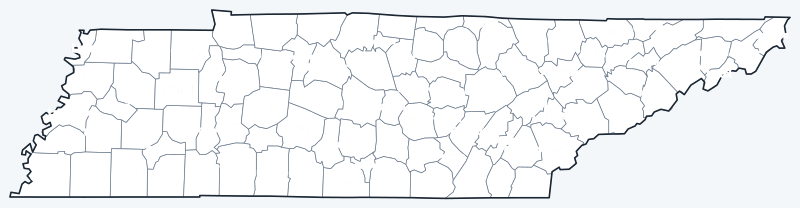
Download the labeled map with county names or the blank map with county lines only, free for personal and classroom use.
Frequently asked questions
How many counties are in Tennessee?
Tennessee has 95 counties. Shelby County is both the most populous and the largest by land area.
What is the largest county in Tennessee?
Shelby County (seat: Memphis) is the largest both by land area, 760.6 sq mi, and by population, with 929,744 residents in 2020.
What county is Nashville in?
Nashville, the state capital, is the county seat of Davidson County.
What county is Memphis in?
Memphis is the county seat of Shelby County, the most populous county in Tennessee.
More Tennessee maps
Back to the Tennessee state map with cities, highways and quick facts.
County maps of neighboring states: Kentucky · Virginia · North Carolina · Georgia · Alabama · Mississippi · Arkansas · Missouri
Browse all 50 state maps.
Sources: U.S. Census Bureau (2020 Census, 2020 Gazetteer, boundaries); county seats from Wikipedia county lists cross-checked with Wikidata. Last reviewed October 2026.