Arkansas County Map
Arkansas has 75 counties. Pulaski County is the most populous, with 399,125 residents in 2020, and Union County is the largest by land area, at 1,039.1 sq mi. The capital, Little Rock, is the county seat of Pulaski County.
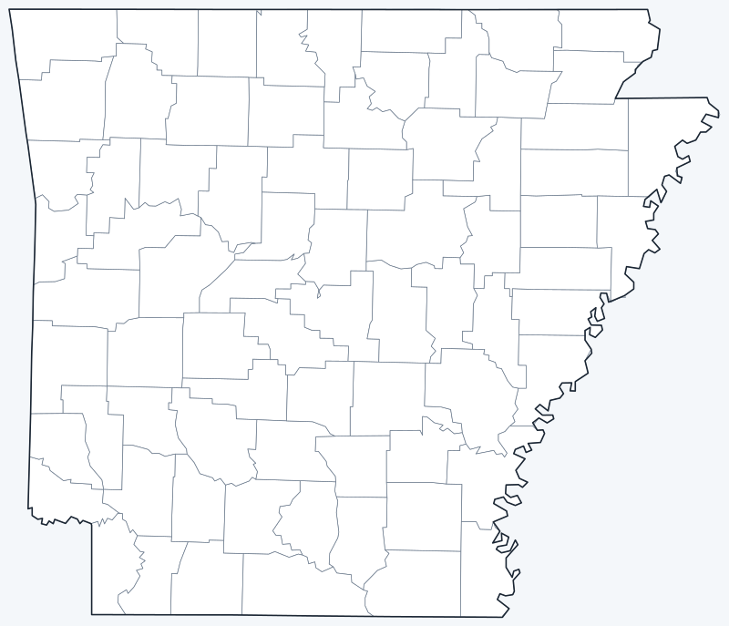
Counties are switched on when the map loads; hover a county for its name, or untick Show counties to hide them.
List of Arkansas counties
All 75 counties in alphabetical order. Click a column heading to sort.
| County | County seat | Population (2020) | Land area (sq mi) |
|---|---|---|---|
| Arkansas County | Stuttgart and DeWitt | 17,149 | 992.1 |
| Ashley County | Hamburg | 19,062 | 925.5 |
| Baxter County | Mountain Home | 41,627 | 553.9 |
| Benton County | Bentonville | 284,333 | 847.7 |
| Boone County | Harrison | 37,373 | 589.7 |
| Bradley County | Warren | 10,545 | 649.2 |
| Calhoun County | Hampton | 4,739 | 628.6 |
| Carroll County | Berryville and Eureka Springs | 28,260 | 629.9 |
| Chicot County | Lake Village | 10,208 | 637.0 |
| Clark County | Arkadelphia | 21,446 | 866.0 |
| Clay County | Piggott and Corning | 14,552 | 639.2 |
| Cleburne County | Heber Springs | 24,711 | 554.0 |
| Cleveland County | Rison | 7,550 | 597.9 |
| Columbia County | Magnolia | 22,801 | 766.1 |
| Conway County | Morrilton | 20,715 | 551.9 |
| Craighead County | Jonesboro and Lake City | 111,231 | 707.2 |
| Crawford County | Van Buren | 60,133 | 595.3 |
| Crittenden County | Marion | 48,163 | 612.9 |
| Cross County | Wynne | 16,833 | 616.3 |
| Dallas County | Fordyce | 6,482 | 667.3 |
| Desha County | Arkansas City | 11,395 | 741.2 |
| Drew County | Monticello | 17,350 | 828.7 |
| Faulkner County | Conway | 123,498 | 647.2 |
| Franklin County | Ozark and Charleston | 17,097 | 609.0 |
| Fulton County | Salem | 12,075 | 618.0 |
| Garland County | Hot Springs | 100,180 | 677.6 |
| Grant County | Sheridan | 17,958 | 631.9 |
| Greene County | Paragould | 45,736 | 577.3 |
| Hempstead County | Hope | 20,065 | 727.2 |
| Hot Spring County | Malvern | 33,040 | 614.9 |
| Howard County | Nashville | 12,785 | 587.3 |
| Independence County | Batesville | 37,938 | 763.7 |
| Izard County | Melbourne | 13,577 | 580.2 |
| Jackson County | Newport | 16,755 | 633.6 |
| Jefferson County | Pine Bluff | 67,260 | 872.4 |
| Johnson County | Clarksville | 25,749 | 661.0 |
| Lafayette County | Lewisville | 6,308 | 529.5 |
| Lawrence County | Walnut Ridge | 16,216 | 587.5 |
| Lee County | Marianna | 8,600 | 599.8 |
| Lincoln County | Star City | 12,941 | 559.5 |
| Little River County | Ashdown | 12,026 | 531.3 |
| Logan County | Booneville and Paris | 21,131 | 709.1 |
| Lonoke County | Lonoke | 74,015 | 771.4 |
| Madison County | Huntsville | 16,521 | 834.2 |
| Marion County | Yellville | 16,826 | 596.7 |
| Miller County | Texarkana | 42,600 | 624.0 |
| Mississippi County | Blytheville and Osceola | 40,685 | 902.1 |
| Monroe County | Clarendon | 6,799 | 607.5 |
| Montgomery County | Mount Ida | 8,484 | 780.5 |
| Nevada County | Prescott | 8,310 | 617.8 |
| Newton County | Jasper | 7,225 | 821.1 |
| Ouachita County | Camden | 22,650 | 732.7 |
| Perry County | Perryville | 10,019 | 551.4 |
| Phillips County | Helena-West Helena | 16,568 | 690.4 |
| Pike County | Murfreesboro | 10,171 | 600.3 |
| Poinsett County | Harrisburg | 22,965 | 758.3 |
| Polk County | Mena | 19,221 | 856.8 |
| Pope County | Russellville | 63,381 | 811.1 |
| Prairie County | Des Arc and DeValls Bluff | 8,282 | 647.5 |
| Pulaski County | Little Rock | 399,125 | 758.3 |
| Randolph County | Pocahontas | 18,571 | 651.9 |
| Saline County | Benton | 123,416 | 723.5 |
| Scott County | Waldron | 9,836 | 892.8 |
| Searcy County | Marshall | 7,828 | 665.8 |
| Sebastian County | Fort Smith and Greenwood | 127,799 | 531.2 |
| Sevier County | De Queen | 15,839 | 563.6 |
| Sharp County | Ash Flat | 17,271 | 604.6 |
| St. Francis County | Forrest City | 23,090 | 634.8 |
| Stone County | Mountain View | 12,359 | 606.4 |
| Union County | El Dorado | 39,054 | 1,039.1 |
| Van Buren County | Clinton | 15,796 | 709.6 |
| Washington County | Fayetteville | 245,871 | 941.5 |
| White County | Searcy | 76,822 | 1,034.1 |
| Woodruff County | Augusta | 6,269 | 586.0 |
| Yell County | Dardanelle and Danville | 20,263 | 930.2 |
Most populous counties
Arkansas had 3,011,524 residents in the 2020 Census. The five most populous counties:
- Pulaski County: 399,125 (13.3% of the state)
- Benton County: 284,333 (9.4% of the state)
- Washington County: 245,871 (8.2% of the state)
- Sebastian County: 127,799 (4.2% of the state)
- Faulkner County: 123,498 (4.1% of the state)
Together these five hold 39.2% of the state’s population. The least populous is Calhoun County, with 4,739 residents.
Benton County and Washington County, in northwest Arkansas, together hold 17.6% of the state’s residents.
Largest and smallest counties
By land area, the largest are Union County (1,039.1 sq mi), White County (1,034.1 sq mi) and Arkansas County (992.1 sq mi). The smallest is Lafayette County, with 529.5 sq mi of land, followed by Sebastian County (531.2 sq mi). The average county covers 693.2 sq mi of land.
How Arkansas counties work
Each Arkansas county is run by an elected county judge, who is the county’s chief executive rather than a court judge, and a quorum court, the county’s legislative body.
Ten of the 75 counties have two county seats: Arkansas County (Stuttgart and DeWitt), Carroll County (Berryville and Eureka Springs), Clay County (Piggott and Corning), Craighead County (Jonesboro and Lake City), Franklin County (Ozark and Charleston), Logan County (Booneville and Paris), Mississippi County (Blytheville and Osceola), Prairie County (Des Arc and DeValls Bluff), Sebastian County (Fort Smith and Greenwood) and Yell County (Dardanelle and Danville).
Little Rock, the capital and largest city, is the seat of Pulaski County.
Printable Arkansas county maps
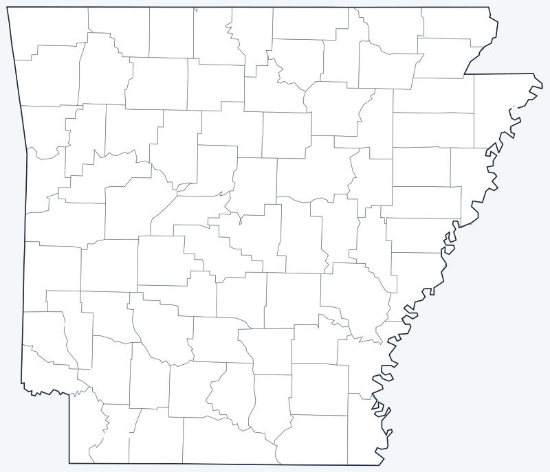
Free to print for personal and classroom use: a labeled map with every county name, and a blank version for quizzes and coloring.
Frequently asked questions
How many counties are in Arkansas?
Arkansas has 75 counties.
What is the largest county in Arkansas?
Union County, with 1,039.1 sq mi of land.
What is the most populous county in Arkansas?
Pulaski County, with 399,125 residents in 2020, 13.3% of the state.
What county is Little Rock in?
Little Rock, the capital and largest city, is the seat of Pulaski County.
More county maps
Back to the Arkansas state map. County maps of neighboring states: Louisiana · Mississippi · Missouri · Oklahoma · Tennessee · Texas.
Browse all 50 state maps.
Sources: U.S. Census Bureau (2020 Census, 2020 Gazetteer, boundaries); county seats: Wikipedia and Wikidata, cross-checked. Last reviewed October 2026.