South Carolina County Map
South Carolina has 46 counties. Greenville County is the most populous, with 525,534 people in 2020, and Horry County, home to Myrtle Beach, is the largest at 1,133.3 sq mi of land. The capital, Columbia, is the seat of Richland County.
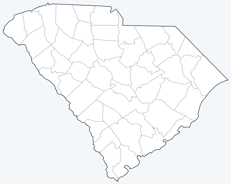
County lines are switched on when the interactive map loads, along with South Carolina’s largest cities (capital in red). Hover a county to see its name, or untick Show counties to hide them.
List of South Carolina counties
| County | County seat | Population (2020) | Land area (sq mi) |
|---|---|---|---|
| Abbeville County | Abbeville | 24,295 | 491.2 |
| Aiken County | Aiken | 168,808 | 1,070.7 |
| Allendale County | Allendale | 8,039 | 408.1 |
| Anderson County | Anderson | 203,718 | 713.9 |
| Bamberg County | Bamberg | 13,311 | 393.4 |
| Barnwell County | Barnwell | 20,589 | 548.4 |
| Beaufort County | Beaufort | 187,117 | 576.0 |
| Berkeley County | Moncks Corner | 229,861 | 1,103.6 |
| Calhoun County | St. Matthews | 14,119 | 381.2 |
| Charleston County | Charleston | 408,235 | 918.0 |
| Cherokee County | Gaffney | 56,216 | 393.0 |
| Chester County | Chester | 32,294 | 580.7 |
| Chesterfield County | Chesterfield | 43,273 | 799.0 |
| Clarendon County | Manning | 31,144 | 607.2 |
| Colleton County | Walterboro | 38,604 | 1,056.5 |
| Darlington County | Darlington | 62,905 | 560.6 |
| Dillon County | Dillon | 28,292 | 405.1 |
| Dorchester County | St. George | 161,540 | 568.6 |
| Edgefield County | Edgefield | 25,657 | 500.7 |
| Fairfield County | Winnsboro | 20,948 | 686.3 |
| Florence County | Florence | 137,059 | 800.5 |
| Georgetown County | Georgetown | 63,404 | 813.6 |
| Greenville County | Greenville | 525,534 | 785.9 |
| Greenwood County | Greenwood | 69,351 | 455.6 |
| Hampton County | Hampton | 18,561 | 560.0 |
| Horry County | Conway | 351,029 | 1,133.3 |
| Jasper County | Ridgeland | 28,791 | 655.2 |
| Kershaw County | Camden | 65,403 | 726.6 |
| Lancaster County | Lancaster | 96,016 | 549.1 |
| Laurens County | Laurens | 67,539 | 712.9 |
| Lee County | Bishopville | 16,531 | 410.2 |
| Lexington County | Lexington | 293,991 | 699.0 |
| Marion County | Marion | 29,183 | 489.4 |
| Marlboro County | Bennettsville | 26,667 | 479.9 |
| McCormick County | McCormick | 9,526 | 358.9 |
| Newberry County | Newberry | 37,719 | 630.3 |
| Oconee County | Walhalla | 78,607 | 626.6 |
| Orangeburg County | Orangeburg | 84,223 | 1,106.4 |
| Pickens County | Pickens | 131,404 | 496.9 |
| Richland County | Columbia | 416,147 | 757.3 |
| Saluda County | Saluda | 18,862 | 452.7 |
| Spartanburg County | Spartanburg | 327,997 | 808.4 |
| Sumter County | Sumter | 105,556 | 665.1 |
| Union County | Union | 27,244 | 513.6 |
| Williamsburg County | Kingstree | 31,026 | 934.2 |
| York County | York | 282,090 | 681.0 |
Most populous counties
South Carolina had 5,118,425 residents in 2020. The five most populous counties held 39.6% of them:
- Greenville County: 525,534 (10.3% of the state)
- Richland County: 416,147 (8.1% of the state)
- Charleston County: 408,235 (8.0% of the state)
- Horry County: 351,029 (6.9% of the state)
- Spartanburg County: 327,997 (6.4% of the state)
Charleston is the largest city, but Charleston County ranks only third among counties; Greenville County in the Upstate is first. The least populous county is Allendale County, with 8,039 residents, followed by McCormick County (9,526) and Bamberg County (13,311).
Largest and smallest counties
Horry County is the largest county at 1,133.3 sq mi of land. Orangeburg County (1,106.4 sq mi) and Berkeley County (1,103.6 sq mi) are close behind. The smallest is McCormick County, on the Georgia border, with 358.9 sq mi, followed by Calhoun County (381.2 sq mi) and Cherokee County (393.0 sq mi).
Coastal counties include large areas of water. Charleston County covers 1,358.0 sq mi in total, of which 918.0 sq mi is land.
How South Carolina counties work
Each of South Carolina’s 46 counties has a county seat and is governed by an elected county council. The Home Rule Act of 1975 moved most county decisions from the state legislature to these councils.
Several cities cross county lines. Columbia, the seat of Richland County, extends into Lexington County, and Charleston, the seat of Charleston County, extends into Berkeley County.
Printable South Carolina county maps
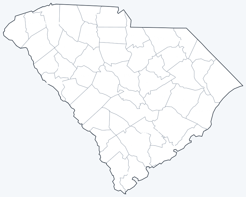
Download the labeled map with every county name, or the blank version for quizzes and coloring; both are SVG files that print sharply at any size.
Frequently asked questions
How many counties are in South Carolina?
There are 46 counties. Greenville County is the most populous and Horry County is the largest by land area.
What is the largest county in South Carolina?
Horry County, with 1,133.3 sq mi of land. By population, the largest is Greenville County.
What is the most populous county in South Carolina?
Greenville County, with 525,534 people in 2020, ahead of Richland County (416,147) and Charleston County (408,235).
What county is Columbia, SC in?
Mostly Richland County, of which Columbia is the county seat. Part of the city lies in Lexington County.
More maps
Back to the South Carolina state map. Neighboring states: Georgia county map · North Carolina county map.
Browse all 50 state maps.
Sources: U.S. Census Bureau (2020 Census, 2020 Gazetteer, boundaries); county seats: Wikipedia and Wikidata. Last reviewed October 2026.