Utah County Map
Utah has 29 counties. Salt Lake County is the most populous, with 1,185,238 residents in 2020, and San Juan County is the largest by land area at 7,819.8 sq mi. Salt Lake City, the capital and largest city, is the county seat of Salt Lake County.
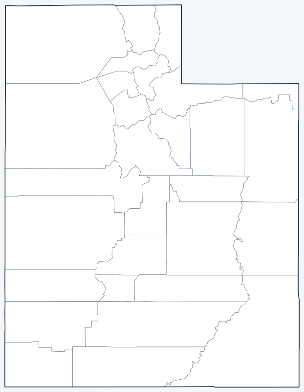
County lines are switched on when the interactive map loads; hover over a county to see its name. Untick Show counties to hide them.
List of Utah counties
| County | County seat | Population (2020) | Land area (sq mi) |
|---|---|---|---|
| Beaver | Beaver | 7,072 | 2,582.9 |
| Box Elder | Brigham City | 57,666 | 5,745.6 |
| Cache | Logan | 133,154 | 1,164.7 |
| Carbon | Price | 20,412 | 1,479.2 |
| Daggett | Manila | 935 | 697.0 |
| Davis | Farmington | 362,679 | 299.1 |
| Duchesne | Duchesne | 19,596 | 3,235.3 |
| Emery | Castle Dale | 9,825 | 4,462.3 |
| Garfield | Panguitch | 5,083 | 5,175.1 |
| Grand | Moab | 9,669 | 3,672.7 |
| Iron | Parowan | 57,289 | 3,296.3 |
| Juab | Nephi | 11,786 | 3,391.7 |
| Kane | Kanab | 7,667 | 3,989.9 |
| Millard | Fillmore | 12,975 | 6,785.5 |
| Morgan | Morgan | 12,295 | 609.2 |
| Piute | Junction | 1,438 | 758.4 |
| Rich | Randolph | 2,510 | 1,028.8 |
| Salt Lake | Salt Lake City | 1,185,238 | 742.1 |
| San Juan | Monticello | 14,518 | 7,819.8 |
| Sanpete | Manti | 28,437 | 1,589.9 |
| Sevier | Richfield | 21,522 | 1,910.4 |
| Summit | Coalville | 42,357 | 1,870.6 |
| Tooele | Tooele | 72,698 | 6,941.9 |
| Uintah | Vernal | 35,620 | 4,482.4 |
| Utah | Provo | 659,399 | 2,004.1 |
| Wasatch | Heber City | 34,788 | 1,177.0 |
| Washington | St. George | 180,279 | 2,427.4 |
| Wayne | Loa | 2,486 | 2,461.0 |
| Weber | Ogden | 262,223 | 576.3 |
Most populous counties
Utah had 3,271,616 residents in the 2020 Census. The five most populous counties hold 81.0% of them:
- Salt Lake County (seat: Salt Lake City): 1,185,238 (36.2% of the state)
- Utah County (seat: Provo): 659,399 (20.2% of the state)
- Davis County (seat: Farmington): 362,679 (11.1% of the state)
- Weber County (seat: Ogden): 262,223 (8.0% of the state)
- Washington County (seat: St. George): 180,279 (5.5% of the state)
At the other end, the least populous counties are Daggett County (935), Piute County (1,438) and Wayne County (2,486).
Largest and smallest counties
Utah’s 29 counties cover 82,376.6 sq mi of land, an average of 2,840.6 sq mi each. The largest by land area are San Juan County (7,819.8 sq mi), Tooele County (6,941.9 sq mi) and Millard County (6,785.5 sq mi).
The smallest is Davis County, with 299.1 sq mi of land, followed by Weber County (576.3 sq mi) and Morgan County (609.2 sq mi). San Juan County is about 26 times the size of Davis County.
Where Utahns live
Most Utahns live in four counties along the western foot of the Wasatch Range: Salt Lake, Utah, Davis and Weber. Together they hold 75.5% of the state’s population on 4.4% of its land area.
Do not confuse Utah County with the state: Utah County, south of Salt Lake County, has its seat at Provo and is the state’s second most populous county. Washington County in the far southwest, with its seat at St. George, ranks fifth by population.
Printable Utah county maps
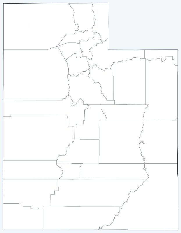
Download the labeled map with county names or the blank map with county lines only, free for personal and classroom use.
Frequently asked questions
How many counties are in Utah?
Utah has 29 counties. The most populous is Salt Lake County and the largest by land area is San Juan County.
What is the largest county in Utah?
By land area, San Juan County (7,819.8 sq mi, seat: Monticello). By population, Salt Lake County, with 1,185,238 residents in 2020.
What county is Salt Lake City in?
Salt Lake City, the state capital, is the county seat of Salt Lake County.
Is Utah County the same as Salt Lake County?
No. Salt Lake County contains Salt Lake City, the state capital. Utah County lies to the south and contains Provo and Orem.
More Utah maps
Back to the Utah state map with cities, highways and quick facts.
County maps of neighboring states: Idaho · Wyoming · Colorado · Arizona · Nevada · New Mexico
Browse all 50 state maps.
Sources: U.S. Census Bureau (2020 Census, 2020 Gazetteer, boundaries); county seats from Wikipedia county lists cross-checked with Wikidata. Last reviewed October 2026.