Idaho County Map
Idaho has 44 counties. Ada County is the most populous, with 494,967 residents in 2020, and Idaho County is the largest by land area at 8,477.5 sq mi. The capital, Boise, is the seat of Ada County.
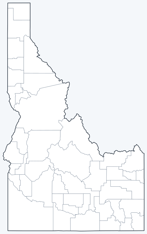
County lines are switched on when the interactive map loads, over an OpenStreetMap base map with major cities (capital in red). Hover over a county to see its name, or untick Show counties to hide the lines.
List of Idaho counties
| County | County seat | Population (2020) | Land area (sq mi) |
|---|---|---|---|
| Ada County | Boise | 494,967 | 1,052.0 |
| Adams County | Council | 4,379 | 1,362.8 |
| Bannock County | Pocatello | 87,018 | 1,112.5 |
| Bear Lake County | Paris | 6,372 | 975.7 |
| Benewah County | St. Maries | 9,530 | 776.9 |
| Bingham County | Blackfoot | 47,992 | 2,093.7 |
| Blaine County | Hailey | 24,272 | 2,637.7 |
| Boise County | Idaho City | 7,610 | 1,899.6 |
| Bonner County | Sandpoint | 47,110 | 1,733.2 |
| Bonneville County | Idaho Falls | 123,964 | 1,866.0 |
| Boundary County | Bonners Ferry | 12,056 | 1,268.7 |
| Butte County | Arco | 2,574 | 2,236.5 |
| Camas County | Fairfield | 1,077 | 1,074.2 |
| Canyon County | Caldwell | 231,105 | 587.0 |
| Caribou County | Soda Springs | 7,027 | 1,764.2 |
| Cassia County | Burley | 24,655 | 2,565.6 |
| Clark County | Dubois | 790 | 1,763.1 |
| Clearwater County | Orofino | 8,734 | 2,457.3 |
| Custer County | Challis | 4,275 | 4,922.2 |
| Elmore County | Mountain Home | 28,666 | 3,075.1 |
| Franklin County | Preston | 14,194 | 663.0 |
| Fremont County | St. Anthony | 13,388 | 1,864.0 |
| Gem County | Emmett | 19,123 | 559.8 |
| Gooding County | Gooding | 15,598 | 729.3 |
| Idaho County | Grangeville | 16,541 | 8,477.5 |
| Jefferson County | Rigby | 30,891 | 1,093.7 |
| Jerome County | Jerome | 24,237 | 597.5 |
| Kootenai County | Coeur d'Alene | 171,362 | 1,237.8 |
| Latah County | Moscow | 39,517 | 1,075.9 |
| Lemhi County | Salmon | 7,974 | 4,563.7 |
| Lewis County | Nezperce | 3,533 | 478.8 |
| Lincoln County | Shoshone | 5,127 | 1,201.4 |
| Madison County | Rexburg | 52,913 | 469.3 |
| Minidoka County | Rupert | 21,613 | 757.0 |
| Nez Perce County | Lewiston | 42,090 | 848.3 |
| Oneida County | Malad City | 4,564 | 1,199.0 |
| Owyhee County | Murphy | 11,913 | 7,668.2 |
| Payette County | Payette | 25,386 | 406.9 |
| Power County | American Falls | 7,878 | 1,403.8 |
| Shoshone County | Wallace | 13,169 | 2,637.4 |
| Teton County | Driggs | 11,630 | 449.1 |
| Twin Falls County | Twin Falls | 90,046 | 1,921.7 |
| Valley County | Cascade | 11,746 | 3,665.1 |
| Washington County | Weiser | 10,500 | 1,452.9 |
Click a column heading to sort. Land area excludes water.
Most populous counties
Idaho had 1,839,106 residents in the 2020 Census. The five most populous counties held 60.4 percent of them:
- Ada County (seat Boise): 494,967, or 26.9 percent of the state
- Canyon County (seat Caldwell): 231,105, or 12.6 percent of the state
- Kootenai County (seat Coeur d'Alene): 171,362, or 9.3 percent of the state
- Bonneville County (seat Idaho Falls): 123,964, or 6.7 percent of the state
- Twin Falls County (seat Twin Falls): 90,046, or 4.9 percent of the state
The least populous is Clark County, with 790 residents. The median Idaho county had 14,194 people in 2020.
Largest and smallest counties
By land area, the largest Idaho counties are Idaho County (8,477.5 sq mi), Owyhee County (7,668.2 sq mi) and Custer County (4,922.2 sq mi). The smallest are Payette County (406.9 sq mi), Teton County (449.1 sq mi) and Madison County (469.3 sq mi).
The average Idaho county covers 1,878.3 sq mi of land. Idaho County is 21 times the land area of Payette County.
Idaho county names that cause confusion
Two Idaho county names trip up map readers. The city of Boise is not in Boise County: it is the seat of Ada County. Boise County lies northeast of the city, in the mountains, and its seat is Idaho City.
Likewise, Idaho County is one of the state’s 44 counties, not a name for the whole state. It stretches across north-central Idaho, and its seat is Grangeville.
Ada County holds the capital and the state’s main metro area along the Boise River, with neighboring Canyon County (seat Caldwell) next to it on the west.
Printable Idaho county maps
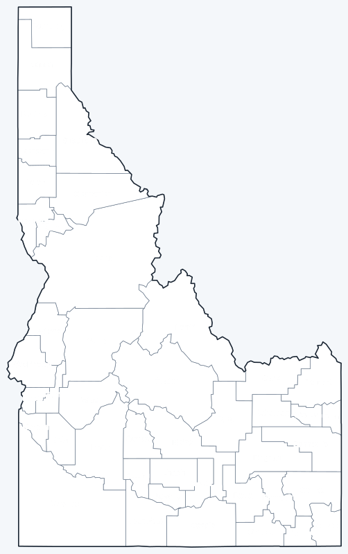
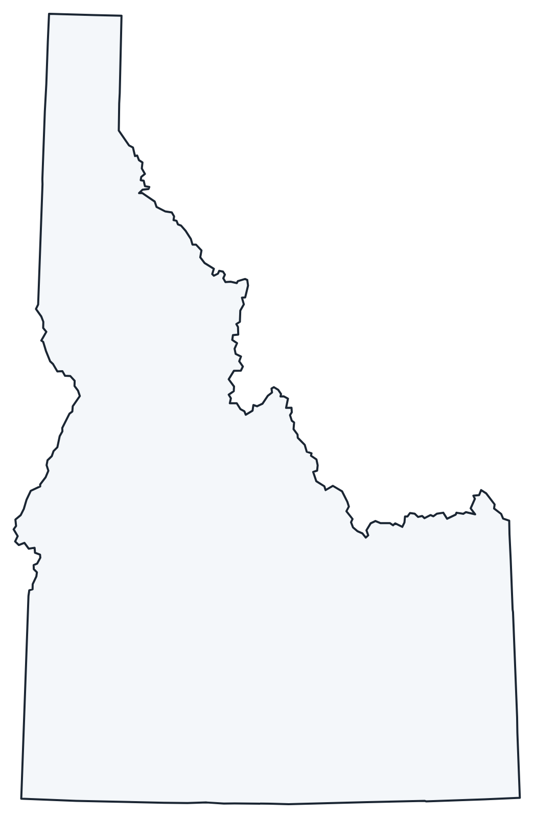
Download the labeled map with every county name, or the blank county map for quizzes and coloring; both are SVG files that print sharply at any size and are free for personal and classroom use.
Frequently asked questions
How many counties are in Idaho?
Idaho has 44 counties. Ada County has the most people and Clark County the fewest.
What is the largest county in Idaho?
Idaho County, with 8,477.5 sq mi of land. Its seat is Grangeville.
What is the most populous county in Idaho?
Ada County, with 494,967 residents in the 2020 Census, 26.9 percent of the state total.
What county is Boise in?
Ada County. Boise is the county seat, and Ada County is Idaho’s most populous county. Boise County is a separate, mostly mountainous county whose seat is Idaho City.
More Idaho and county maps
See the Idaho state map for cities, geography and highways.
County maps of neighboring states: Montana · Nevada · Oregon · Utah · Washington · Wyoming
Browse all 50 state maps.
Sources: U.S. Census Bureau (2020 Census, 2020 Gazetteer, boundaries); county seats from Wikipedia county lists cross-checked with Wikidata. Last reviewed October 2026.