Oregon County Map
Oregon has 36 counties. Multnomah County, home to Portland, is the most populous with 815,428 people in 2020, and Harney County in the high desert is the largest at 10,134.4 sq mi of land. The capital, Salem, is the seat of Marion County.
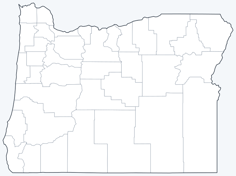
County lines are switched on when the interactive map loads, along with Oregon’s largest cities (capital in red). Hover a county to see its name, or untick Show counties to hide them.
List of Oregon counties
| County | County seat | Population (2020) | Land area (sq mi) |
|---|---|---|---|
| Baker County | Baker City | 16,668 | 3,068.0 |
| Benton County | Corvallis | 95,184 | 675.2 |
| Clackamas County | Oregon City | 421,401 | 1,870.7 |
| Clatsop County | Astoria | 41,072 | 828.1 |
| Columbia County | St. Helens | 52,589 | 658.7 |
| Coos County | Coquille | 64,929 | 1,596.1 |
| Crook County | Prineville | 24,738 | 2,978.9 |
| Curry County | Gold Beach | 23,446 | 1,628.4 |
| Deschutes County | Bend | 198,253 | 3,017.6 |
| Douglas County | Roseburg | 111,201 | 5,035.7 |
| Gilliam County | Condon | 1,995 | 1,204.7 |
| Grant County | Canyon City | 7,233 | 4,527.8 |
| Harney County | Burns | 7,495 | 10,134.4 |
| Hood River County | Hood River | 23,977 | 522.1 |
| Jackson County | Medford | 223,259 | 2,783.3 |
| Jefferson County | Madras | 24,502 | 1,781.7 |
| Josephine County | Grants Pass | 88,090 | 1,638.6 |
| Klamath County | Klamath Falls | 69,413 | 5,950.0 |
| Lake County | Lakeview | 8,160 | 8,138.6 |
| Lane County | Eugene | 382,971 | 4,554.1 |
| Lincoln County | Newport | 50,395 | 981.0 |
| Linn County | Albany | 128,610 | 2,289.3 |
| Malheur County | Vale | 31,571 | 9,887.7 |
| Marion County | Salem | 345,920 | 1,181.1 |
| Morrow County | Heppner | 12,186 | 2,030.5 |
| Multnomah County | Portland | 815,428 | 431.2 |
| Polk County | Dallas | 87,433 | 740.9 |
| Sherman County | Moro | 1,870 | 823.6 |
| Tillamook County | Tillamook | 27,390 | 1,102.4 |
| Umatilla County | Pendleton | 80,075 | 3,215.4 |
| Union County | La Grande | 26,196 | 2,036.9 |
| Wallowa County | Enterprise | 7,391 | 3,145.9 |
| Wasco County | The Dalles | 26,670 | 2,381.1 |
| Washington County | Hillsboro | 600,372 | 724.3 |
| Wheeler County | Fossil | 1,451 | 1,716.0 |
| Yamhill County | McMinnville | 107,722 | 715.9 |
Most populous counties
Oregon had 4,237,256 residents in 2020, and five counties held 60.6% of them:
- Multnomah County: 815,428 (19.2% of the state)
- Washington County: 600,372 (14.2% of the state)
- Clackamas County: 421,401 (9.9% of the state)
- Lane County: 382,971 (9.0% of the state)
- Marion County: 345,920 (8.2% of the state)
The three Portland-area counties, Multnomah, Washington and Clackamas, had 1,837,201 people combined, 43.4% of the state. The least populous county is Wheeler County, with 1,451 residents; 7 of the 36 counties had fewer than 10,000.
Largest and smallest counties
Harney County is the largest county at 10,134.4 sq mi of land, followed by Malheur County (9,887.7 sq mi) and Lake County (8,138.6 sq mi). These three southeastern counties cover 29.3% of Oregon’s land but had only 47,226 residents in 2020.
The smallest county by land area is Multnomah County, at 431.2 sq mi, which is also the most populous. Hood River County (522.1 sq mi) and Columbia County (658.7 sq mi) are the next smallest.
How Oregon counties work
Each of Oregon’s 36 counties has a county seat and an elected governing body, usually a board of commissioners. Counties may also adopt home rule charters that set their own form of government, as Multnomah County has.
City limits do not follow county lines. Portland, the seat of Multnomah County, extends into Washington and Clackamas counties, and Salem, the seat of Marion County, extends west across the Willamette River into Polk County.
Printable Oregon county maps
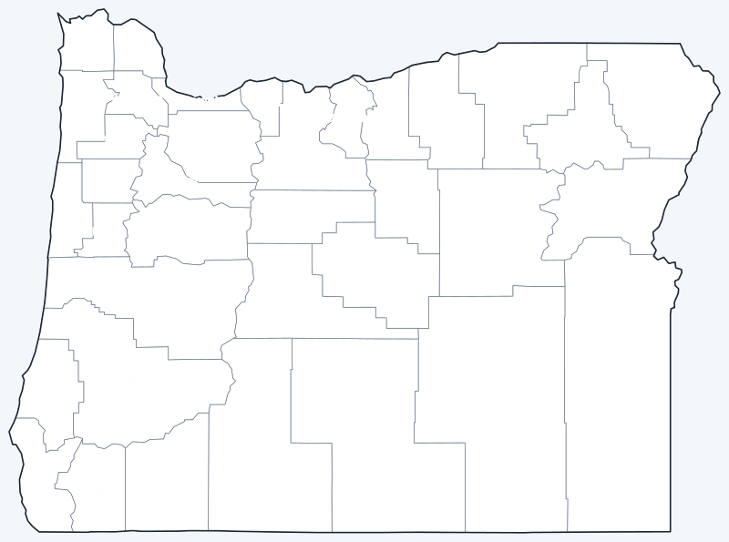
Download the labeled map with every county name, or the blank version for quizzes and coloring; both are SVG files that print sharply at any size.
Frequently asked questions
How many counties are in Oregon?
There are 36 counties. Multnomah County is the most populous and Harney County is the largest by land area.
What is the largest county in Oregon?
Harney County, with 10,134.4 sq mi of land. It had 7,495 residents in 2020.
What is the most populous county in Oregon?
Multnomah County, with 815,428 people in 2020. It is also the smallest county by land area.
What county is Portland, Oregon in?
Mostly Multnomah County, of which Portland is the county seat. Parts of the city lie in Washington and Clackamas counties.
More maps
Back to the Oregon state map. Neighboring states: California county map · Idaho county map · Nevada county map · Washington county map.
Browse all 50 state maps.
Sources: U.S. Census Bureau (2020 Census, 2020 Gazetteer, boundaries); county seats: Wikipedia and Wikidata. Last reviewed October 2026.