California County Map
California has 58 counties. Los Angeles County is the most populous, with 10,014,009 residents in 2020, and San Bernardino County is the largest by land area, at 20,068.0 sq mi. The capital, Sacramento, is the county seat of Sacramento County.
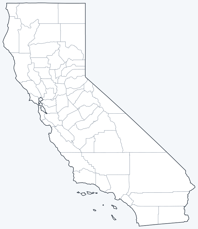
Counties are switched on when the map loads; hover a county for its name, or untick Show counties to hide them.
List of California counties
All 58 counties in alphabetical order. Click a column heading to sort.
| County | County seat | Population (2020) | Land area (sq mi) |
|---|---|---|---|
| Alameda County | Oakland | 1,682,353 | 737.5 |
| Alpine County | Markleeville | 1,204 | 738.3 |
| Amador County | Jackson | 40,474 | 594.6 |
| Butte County | Oroville | 211,632 | 1,636.5 |
| Calaveras County | San Andreas | 45,292 | 1,020.0 |
| Colusa County | Colusa | 21,839 | 1,150.7 |
| Contra Costa County | Martinez | 1,165,927 | 716.9 |
| Del Norte County | Crescent City | 27,743 | 1,006.2 |
| El Dorado County | Placerville | 191,185 | 1,707.8 |
| Fresno County | Fresno | 1,008,654 | 5,958.4 |
| Glenn County | Willows | 28,917 | 1,314.0 |
| Humboldt County | Eureka | 136,463 | 3,568.2 |
| Imperial County | El Centro | 179,702 | 4,175.5 |
| Inyo County | Independence | 19,016 | 10,197.3 |
| Kern County | Bakersfield | 909,235 | 8,134.6 |
| Kings County | Hanford | 152,486 | 1,391.0 |
| Lake County | Lakeport | 68,163 | 1,256.6 |
| Lassen County | Susanville | 32,730 | 4,541.3 |
| Los Angeles County | Los Angeles | 10,014,009 | 4,059.3 |
| Madera County | Madera | 156,255 | 2,136.9 |
| Marin County | San Rafael | 262,321 | 520.4 |
| Mariposa County | Mariposa | 17,131 | 1,448.8 |
| Mendocino County | Ukiah | 91,601 | 3,506.8 |
| Merced County | Merced | 281,202 | 1,938.0 |
| Modoc County | Alturas | 8,700 | 3,948.2 |
| Mono County | Bridgeport | 13,195 | 3,048.9 |
| Monterey County | Salinas | 439,035 | 3,281.7 |
| Napa County | Napa | 138,019 | 748.3 |
| Nevada County | Nevada City | 102,241 | 957.8 |
| Orange County | Santa Ana | 3,186,989 | 792.8 |
| Placer County | Auburn | 404,739 | 1,407.1 |
| Plumas County | Quincy | 19,790 | 2,553.1 |
| Riverside County | Riverside | 2,418,185 | 7,209.3 |
| Sacramento County | Sacramento | 1,585,055 | 965.3 |
| San Benito County | Hollister | 64,209 | 1,388.7 |
| San Bernardino County | San Bernardino | 2,181,654 | 20,068.0 |
| San Diego County | San Diego | 3,298,634 | 4,210.2 |
| San Francisco County | San Francisco | 873,965 | 46.9 |
| San Joaquin County | Stockton | 779,233 | 1,392.4 |
| San Luis Obispo County | San Luis Obispo | 282,424 | 3,300.9 |
| San Mateo County | Redwood City | 764,442 | 448.6 |
| Santa Barbara County | Santa Barbara | 448,229 | 2,733.9 |
| Santa Clara County | San Jose | 1,936,259 | 1,291.1 |
| Santa Cruz County | Santa Cruz | 270,861 | 445.1 |
| Shasta County | Redding | 182,155 | 3,775.5 |
| Sierra County | Downieville | 3,236 | 953.2 |
| Siskiyou County | Yreka | 44,076 | 6,278.8 |
| Solano County | Fairfield | 453,491 | 821.8 |
| Sonoma County | Santa Rosa | 488,863 | 1,575.6 |
| Stanislaus County | Modesto | 552,878 | 1,496.0 |
| Sutter County | Yuba City | 99,633 | 602.7 |
| Tehama County | Red Bluff | 65,829 | 2,949.1 |
| Trinity County | Weaverville | 16,112 | 3,179.3 |
| Tulare County | Visalia | 473,117 | 4,823.9 |
| Tuolumne County | Sonora | 55,620 | 2,220.9 |
| Ventura County | Ventura | 843,843 | 1,840.8 |
| Yolo County | Woodland | 216,403 | 1,014.7 |
| Yuba County | Marysville | 81,575 | 632.0 |
Most populous counties
California had 39,538,223 residents in the 2020 Census. The five most populous counties:
- Los Angeles County: 10,014,009 (25.3% of the state)
- San Diego County: 3,298,634 (8.3% of the state)
- Orange County: 3,186,989 (8.1% of the state)
- Riverside County: 2,418,185 (6.1% of the state)
- San Bernardino County: 2,181,654 (5.5% of the state)
Together these five hold 53.4% of the state’s population. The least populous is Alpine County, with 1,204 residents.
Los Angeles County is the most populous county in the United States. California has 10 counties with more than one million residents.
Largest and smallest counties
By land area, the largest are San Bernardino County (20,068.0 sq mi), Inyo County (10,197.3 sq mi) and Kern County (8,134.6 sq mi). The smallest is San Francisco County, with 46.9 sq mi of land, followed by Santa Cruz County (445.1 sq mi). The average county covers 2,687.2 sq mi of land.
San Bernardino County is the largest county by area in the contiguous United States. San Francisco County has 46.9 sq mi of land but 231.9 sq mi in total; the difference is water.
How California counties work
Each of California’s 58 counties is governed by an elected board of supervisors. San Francisco is the state’s only consolidated city and county: a single government serves as both, so the city and county share the same boundaries.
Sacramento, the capital, is the seat of Sacramento County. Los Angeles, the largest city, is the seat of Los Angeles County.
Printable California county maps
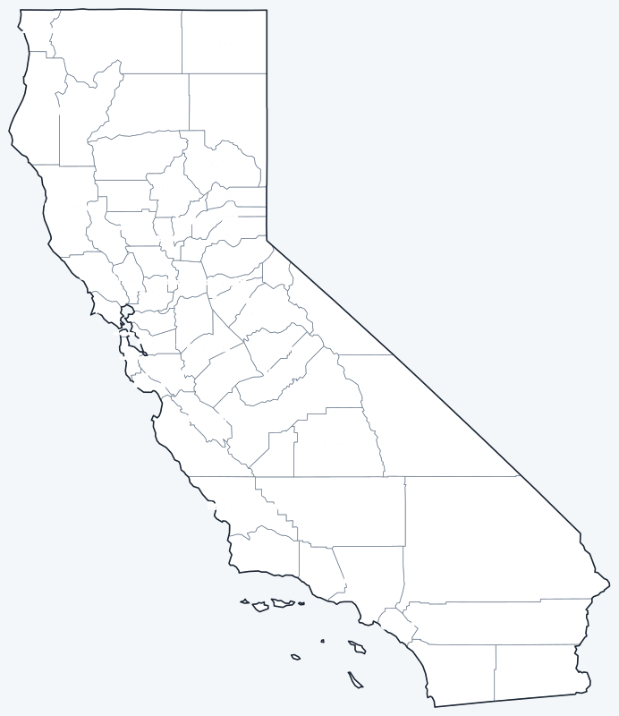
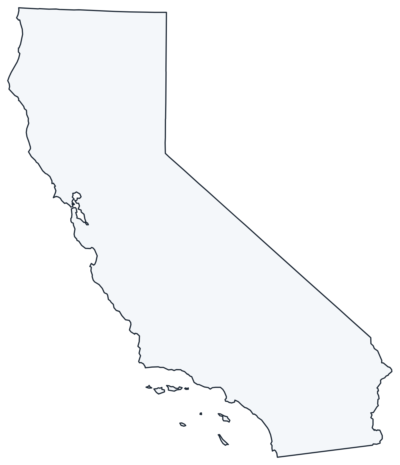
Free to print for personal and classroom use: a labeled map with every county name, and a blank version for quizzes and coloring.
Frequently asked questions
How many counties are in California?
California has 58 counties.
What is the largest county in California?
San Bernardino County, with 20,068.0 sq mi of land.
What is the most populous county in California?
Los Angeles County, with 10,014,009 residents in 2020, 25.3% of the state.
What county is Los Angeles in?
Los Angeles, the largest city, is the seat of Los Angeles County.
More county maps
Back to the California state map. County maps of neighboring states: Arizona · Nevada · Oregon.
Browse all 50 state maps.
Sources: U.S. Census Bureau (2020 Census, 2020 Gazetteer, boundaries); county seats: Wikipedia and Wikidata, cross-checked. Last reviewed October 2026.