Washington County Map
Washington has 39 counties. King County is the most populous, with 2,269,675 people in 2020, and Okanogan County is the largest by land area at 5,266.2 sq mi. The capital, Olympia, is the seat of Thurston County.
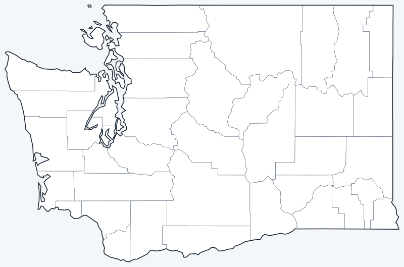
County lines are switched on when the interactive map loads. Hover over a county to see its name, or untick Show counties to hide the lines.
List of Washington counties
| County | County seat | Population (2020) | Land area (sq mi) |
|---|---|---|---|
| Adams | Ritzville | 20,613 | 1,925.0 |
| Asotin | Asotin | 22,285 | 636.1 |
| Benton | Prosser | 206,873 | 1,700.1 |
| Chelan | Wenatchee | 79,074 | 2,921.2 |
| Clallam | Port Angeles | 77,155 | 1,738.7 |
| Clark | Vancouver | 503,311 | 628.5 |
| Columbia | Dayton | 3,952 | 868.6 |
| Cowlitz | Kelso | 110,730 | 1,141.2 |
| Douglas | Waterville | 42,938 | 1,819.2 |
| Ferry | Republic | 7,178 | 2,203.2 |
| Franklin | Pasco | 96,749 | 1,241.6 |
| Garfield | Pomeroy | 2,286 | 710.8 |
| Grant | Ephrata | 99,123 | 2,679.6 |
| Grays Harbor | Montesano | 75,636 | 1,901.5 |
| Island | Coupeville | 86,857 | 208.5 |
| Jefferson | Port Townsend | 32,977 | 1,803.7 |
| King | Seattle | 2,269,675 | 2,115.2 |
| Kitsap | Port Orchard | 275,611 | 395.1 |
| Kittitas | Ellensburg | 44,337 | 2,297.3 |
| Klickitat | Goldendale | 22,735 | 1,871.6 |
| Lewis | Chehalis | 82,149 | 2,402.8 |
| Lincoln | Davenport | 10,876 | 2,310.6 |
| Mason | Shelton | 65,726 | 959.5 |
| Okanogan | Okanogan | 42,104 | 5,266.2 |
| Pacific | South Bend | 23,365 | 933.6 |
| Pend Oreille | Newport | 13,401 | 1,400.2 |
| Pierce | Tacoma | 921,130 | 1,668.0 |
| San Juan | Friday Harbor | 17,788 | 173.9 |
| Skagit | Mount Vernon | 129,523 | 1,730.2 |
| Skamania | Stevenson | 12,036 | 1,658.3 |
| Snohomish | Everett | 827,957 | 2,086.5 |
| Spokane | Spokane | 539,339 | 1,764.2 |
| Stevens | Colville | 46,445 | 2,477.1 |
| Thurston | Olympia | 294,793 | 722.5 |
| Wahkiakum | Cathlamet | 4,422 | 262.9 |
| Walla Walla | Walla Walla | 62,584 | 1,270.0 |
| Whatcom | Bellingham | 226,847 | 2,107.9 |
| Whitman | Colfax | 47,973 | 2,159.3 |
| Yakima | Yakima | 256,728 | 4,294.5 |
Most populous counties
The five most populous counties had 5,061,412 residents in 2020, 65.7% of Washington’s 7,705,281 people.
- King County: 2,269,675 (29.5% of the state), seat Seattle
- Pierce County: 921,130 (12.0% of the state), seat Tacoma
- Snohomish County: 827,957 (10.7% of the state), seat Everett
- Spokane County: 539,339 (7.0% of the state), seat Spokane
- Clark County: 503,311 (6.5% of the state), seat Vancouver
The least populous is Garfield County, with 2,286 residents. Of the 39 counties, 4 had fewer than 10,000 people in 2020.
Largest and smallest counties
By land area, the largest counties are Okanogan (5,266.2 sq mi), Yakima (4,294.5 sq mi) and Chelan (2,921.2 sq mi). The smallest is San Juan County at 173.9 sq mi, followed by Island (208.5 sq mi) and Wahkiakum (262.9 sq mi).
The average Washington county covers 1,704.0 sq mi of land. The most densely populated is King County, with about 1,073 people per sq mi; the least dense is Garfield County, with about 3.2.
How counties work in Washington
Each Washington county has a county seat, listed in the table above, where the county courthouse and main county offices are.
Population is concentrated around Puget Sound. King, Pierce and Snohomish counties together had 4,018,762 residents in 2020, 52.2% of the state. King County is the only county with more than 1 million people. East of the Cascades, Okanogan County, the largest, covers 5,266.2 sq mi but had 42,104 residents.
Two counties consist of islands: San Juan County, made up of the San Juan Islands, and Island County, made up mainly of Whidbey and Camano islands.
Printable Washington county maps
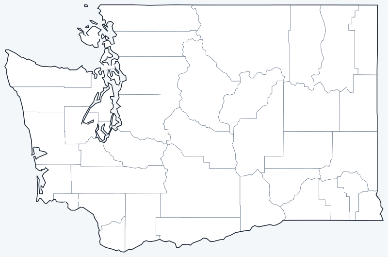
The labeled map shows every county name; the blank version has county lines only, for coloring, quizzes or school projects. Free for personal and classroom use.

Frequently asked questions
How many counties are in Washington?
Washington has 39 counties, each with its own county seat (see the table above).
What is the largest county in Washington?
Okanogan County, with 5,266.2 sq mi of land. Its seat is Okanogan.
What is the most populous county in Washington?
King County, with 2,269,675 residents in the 2020 Census. Its seat is Seattle.
What county is Olympia, Washington, in?
Olympia, the state capital, is in Thurston County and is its county seat. Seattle is the seat of King County.
Neighboring state county maps
Back to the Washington state map or browse all 50 state maps.
Sources: U.S. Census Bureau (2020 Census, 2020 Gazetteer, boundaries); county seats from Wikipedia county lists cross-checked with Wikidata. Last reviewed October 2026.