Alaska Borough Map
Alaska has no counties. For the 2020 Census it was divided into 19 boroughs and 11 census areas, 30 county-equivalents in all. Anchorage Municipality is the most populous, with 291,247 residents, and Yukon-Koyukuk Census Area is the largest, with 145,575.5 sq mi of land. The capital, Juneau, is the seat of Juneau City and Borough.
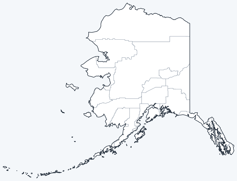
Boroughs and census areas are switched on when the map loads; hover one for its name, or untick Show counties to hide them. The map still shows the former Valdez-Cordova Census Area as one shape: since 2019 it has been two census areas, Chugach and Copper River, which is why the map has 29 shapes and the table 30 rows.
List of Alaska boroughs and census areas
All 30 boroughs and census areas in alphabetical order. Click a column heading to sort. Census areas have no seat (—).
| Borough or census area | Seat | Population (2020) | Land area (sq mi) |
|---|---|---|---|
| Aleutians East Borough | Sand Point | 3,420 | 6,985.2 |
| Aleutians West Census Area | — | 5,232 | 4,393.0 |
| Anchorage Municipality | Anchorage | 291,247 | 1,706.8 |
| Bethel Census Area | — | 18,666 | 40,627.1 |
| Bristol Bay Borough | Naknek | 844 | 482.0 |
| Chugach Census Area | — | 7,102 | 9,529.8 |
| Copper River Census Area | — | 2,617 | 24,692.1 |
| Denali Borough | Healy | 1,619 | 12,641.0 |
| Dillingham Census Area | — | 4,857 | 18,334.0 |
| Fairbanks North Star Borough | Fairbanks | 95,655 | 7,334.8 |
| Haines Borough | Haines | 2,080 | 2,343.4 |
| Hoonah-Angoon Census Area | — | 2,365 | 6,555.3 |
| Juneau City and Borough | Juneau | 32,255 | 2,704.0 |
| Kenai Peninsula Borough | Soldotna | 58,799 | 16,017.4 |
| Ketchikan Gateway Borough | Ketchikan | 13,948 | 4,856.9 |
| Kodiak Island Borough | Kodiak | 13,101 | 6,688.9 |
| Kusilvak Census Area | — | 8,368 | 17,077.1 |
| Lake and Peninsula Borough | King Salmon | 1,476 | 23,831.8 |
| Matanuska-Susitna Borough | Palmer | 107,081 | 24,707.0 |
| Nome Census Area | — | 10,046 | 22,969.5 |
| North Slope Borough | Utqiagvik | 11,031 | 88,823.6 |
| Northwest Arctic Borough | Kotzebue | 7,793 | 35,663.3 |
| Petersburg Borough | Petersburg | 3,398 | 2,900.7 |
| Prince of Wales-Hyder Census Area | — | 5,753 | 5,267.7 |
| Sitka City and Borough | Sitka | 8,458 | 2,870.1 |
| Skagway Municipality | Skagway | 1,240 | 433.9 |
| Southeast Fairbanks Census Area | — | 6,808 | 24,831.1 |
| Wrangell City and Borough | Wrangell | 2,127 | 2,556.0 |
| Yakutat City and Borough | Yakutat | 662 | 7,623.3 |
| Yukon-Koyukuk Census Area | — | 5,343 | 145,575.5 |
Most populous boroughs
Alaska had 733,391 residents in the 2020 Census. The five most populous boroughs:
- Anchorage Municipality: 291,247 (39.7% of the state)
- Matanuska-Susitna Borough: 107,081 (14.6% of the state)
- Fairbanks North Star Borough: 95,655 (13.0% of the state)
- Kenai Peninsula Borough: 58,799 (8.0% of the state)
- Juneau City and Borough: 32,255 (4.4% of the state)
Together these five hold 79.8% of the state’s population. The least populous is Yakutat City and Borough, with 662 residents.
Largest and smallest boroughs
By land area, the largest are Yukon-Koyukuk Census Area (145,575.5 sq mi), North Slope Borough (88,823.6 sq mi) and Bethel Census Area (40,627.1 sq mi). The smallest is Skagway Municipality, with 433.9 sq mi of land, followed by Bristol Bay Borough (482.0 sq mi). The average borough or census area covers 19,034.1 sq mi of land.
Yukon-Koyukuk Census Area alone covers 25.5% of Alaska’s land.
Boroughs and census areas
Alaska uses boroughs instead of counties. The 19 organized boroughs are regional governments; some, such as Anchorage, Juneau and Sitka, are consolidated city-boroughs in which one government serves both the city and the borough.
Land outside the organized boroughs forms the Unorganized Borough, which has no borough government; the state provides regional services there. For statistics, the Census Bureau divides it into 11 census areas. Census areas have no government and no seat, so the seat column shows a dash for them. Together they cover 56.0% of Alaska’s land but hold 10.5% of its people.
In 2019 the Valdez-Cordova Census Area was split into Chugach Census Area and Copper River Census Area. The table lists both, as the 2020 Census does, but the map boundaries still show the former Valdez-Cordova Census Area as one shape, so the maps have 29 shapes for 30 rows. Kusilvak Census Area was called Wade Hampton Census Area until 2015.
Printable Alaska borough maps
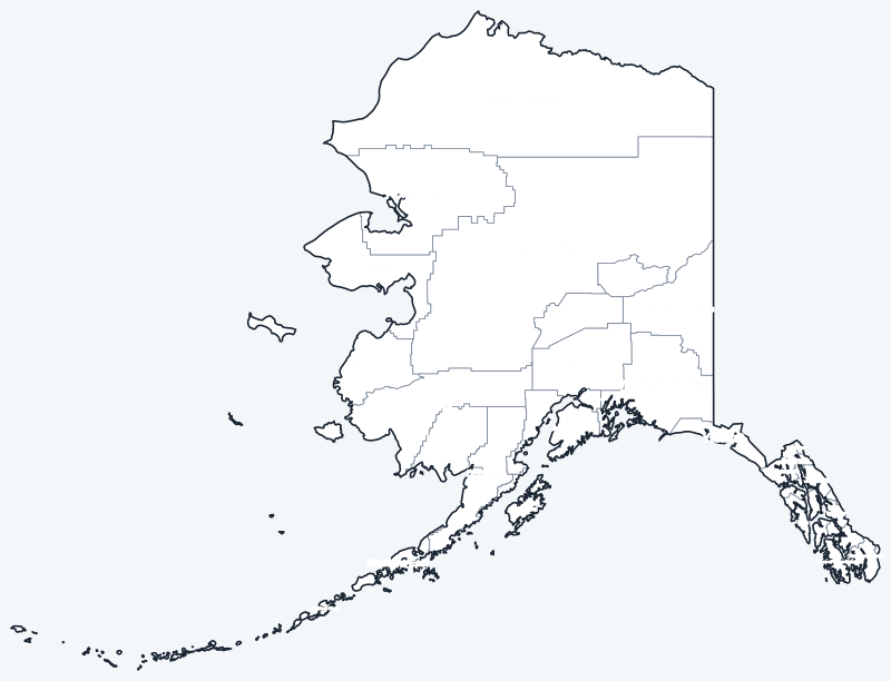
Free to print for personal and classroom use: a labeled map with every borough and census area name, and a blank version for quizzes and coloring.
Frequently asked questions
How many boroughs are in Alaska?
Alaska has 19 organized boroughs. The rest of the state, the Unorganized Borough, is divided into 11 census areas, for 30 county-equivalents in the 2020 Census.
What is the largest borough in Alaska?
Yukon-Koyukuk Census Area, with 145,575.5 sq mi of land, is the largest county-equivalent. The largest organized borough is North Slope Borough (88,823.6 sq mi).
What is the most populous borough in Alaska?
Anchorage Municipality, with 291,247 residents in 2020, 39.7% of the state.
What borough is Juneau in?
Juneau, the state capital, is the seat of Juneau City and Borough, a consolidated city-borough: one government serves both the city and the borough.
More county maps
Back to the Alaska state map. Alaska borders no other state; county maps of the other Pacific states: Washington · Oregon · California · Hawaii.
Browse all 50 state maps.
Sources: U.S. Census Bureau (2020 Census, 2020 Gazetteer, boundaries); borough seats: Wikipedia and Wikidata, cross-checked. Last reviewed October 2026.