South Dakota County Map
South Dakota has 66 counties. Minnehaha County is the most populous, with 197,214 residents in 2020, and Meade County is the largest by land area at 3,470.9 sq mi. The capital, Pierre, is the county seat of Hughes County; the largest city, Sioux Falls, is the seat of Minnehaha County.
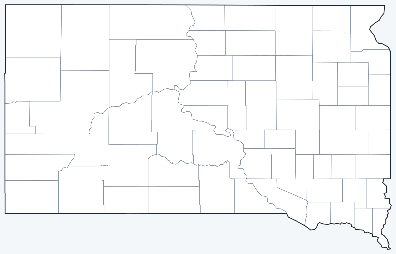
County lines are switched on when the interactive map loads; hover over a county to see its name. Untick Show counties to hide them.
List of South Dakota counties
| County | County seat | Population (2020) | Land area (sq mi) |
|---|---|---|---|
| Aurora | Plankinton | 2,747 | 708.5 |
| Beadle | Huron | 19,149 | 1,258.7 |
| Bennett | Martin | 3,381 | 1,184.6 |
| Bon Homme | Tyndall | 7,003 | 563.5 |
| Brookings | Brookings | 34,375 | 792.2 |
| Brown | Aberdeen | 38,301 | 1,713.0 |
| Brule | Chamberlain | 5,247 | 817.2 |
| Buffalo | Gann Valley | 1,948 | 471.4 |
| Butte | Belle Fourche | 10,243 | 2,250.0 |
| Campbell | Mound City | 1,377 | 733.7 |
| Charles Mix | Lake Andes | 9,373 | 1,097.5 |
| Clark | Clark | 3,837 | 957.5 |
| Clay | Vermillion | 14,967 | 412.0 |
| Codington | Watertown | 28,325 | 687.6 |
| Corson | McIntosh | 3,902 | 2,469.7 |
| Custer | Custer | 8,318 | 1,556.9 |
| Davison | Mitchell | 19,956 | 435.6 |
| Day | Webster | 5,449 | 1,028.5 |
| Deuel | Clear Lake | 4,295 | 622.7 |
| Dewey | Timber Lake | 5,239 | 2,302.4 |
| Douglas | Armour | 2,835 | 431.8 |
| Edmunds | Ipswich | 3,986 | 1,126.0 |
| Fall River | Hot Springs | 6,973 | 1,739.9 |
| Faulk | Faulkton | 2,125 | 981.7 |
| Grant | Milbank | 7,556 | 681.4 |
| Gregory | Burke | 3,994 | 1,014.9 |
| Haakon | Philip | 1,872 | 1,810.5 |
| Hamlin | Hayti | 6,164 | 507.0 |
| Hand | Miller | 3,145 | 1,436.6 |
| Hanson | Alexandria | 3,461 | 434.6 |
| Harding | Buffalo | 1,311 | 2,671.6 |
| Hughes | Pierre | 17,765 | 741.5 |
| Hutchinson | Olivet | 7,427 | 813.0 |
| Hyde | Highmore | 1,262 | 860.6 |
| Jackson | Kadoka | 2,806 | 1,863.9 |
| Jerauld | Wessington Springs | 1,663 | 526.1 |
| Jones | Murdo | 917 | 969.7 |
| Kingsbury | De Smet | 5,187 | 832.2 |
| Lake | Madison | 11,059 | 562.9 |
| Lawrence | Deadwood | 25,768 | 800.1 |
| Lincoln | Canton | 65,161 | 577.3 |
| Lyman | Kennebec | 3,718 | 1,642.3 |
| Marshall | Britton | 4,306 | 838.1 |
| McCook | Salem | 5,682 | 574.2 |
| McPherson | Leola | 2,411 | 1,136.7 |
| Meade | Sturgis | 29,852 | 3,470.9 |
| Mellette | White River | 1,918 | 1,307.3 |
| Miner | Howard | 2,298 | 570.2 |
| Minnehaha | Sioux Falls | 197,214 | 806.8 |
| Moody | Flandreau | 6,336 | 519.4 |
| Oglala Lakota | — | 13,672 | 2,093.6 |
| Pennington | Rapid City | 109,222 | 2,776.8 |
| Perkins | Bison | 2,835 | 2,870.5 |
| Potter | Gettysburg | 2,472 | 861.1 |
| Roberts | Sisseton | 10,280 | 1,101.1 |
| Sanborn | Woonsocket | 2,330 | 569.2 |
| Spink | Redfield | 6,361 | 1,503.5 |
| Stanley | Fort Pierre | 2,980 | 1,444.4 |
| Sully | Onida | 1,446 | 1,006.7 |
| Todd | — | 9,319 | 1,388.6 |
| Tripp | Winner | 5,624 | 1,612.5 |
| Turner | Parker | 8,673 | 617.1 |
| Union | Elk Point | 16,811 | 460.8 |
| Walworth | Selby | 5,315 | 708.6 |
| Yankton | Yankton | 23,310 | 521.2 |
| Ziebach | Dupree | 2,413 | 1,961.2 |
Most populous counties
South Dakota had 886,667 residents in the 2020 Census. The five most populous counties hold 50.1% of them:
- Minnehaha County (seat: Sioux Falls): 197,214 (22.2% of the state)
- Pennington County (seat: Rapid City): 109,222 (12.3% of the state)
- Lincoln County (seat: Canton): 65,161 (7.3% of the state)
- Brown County (seat: Aberdeen): 38,301 (4.3% of the state)
- Brookings County (seat: Brookings): 34,375 (3.9% of the state)
At the other end, the least populous counties are Jones County (917), Hyde County (1,262) and Harding County (1,311).
Largest and smallest counties
South Dakota’s 66 counties cover 75,809.3 sq mi of land, an average of 1,148.6 sq mi each. The largest by land area are Meade County (3,470.9 sq mi), Perkins County (2,870.5 sq mi) and Pennington County (2,776.8 sq mi).
The smallest is Clay County, with 412.0 sq mi of land, followed by Douglas County (431.8 sq mi) and Hanson County (434.6 sq mi). Meade County is about 8 times the size of Clay County.
Unorganized counties in South Dakota
Oglala Lakota County and Todd County have no county seat because they are unorganized: they lie within the Pine Ridge and Rosebud Indian reservations, and county services are provided by neighboring counties. Oglala Lakota County is attached to Fall River County (seat: Hot Springs) and Todd County to Tripp County (seat: Winner). Oglala Lakota County was called Shannon County until 2015. The table shows “—” in the seat column for both.
The Missouri River divides the state into East River and West River. Most of the large counties by area are West River ranch counties, while Minnehaha, Lincoln and Brookings counties in the east hold the larger towns.
Printable South Dakota county maps
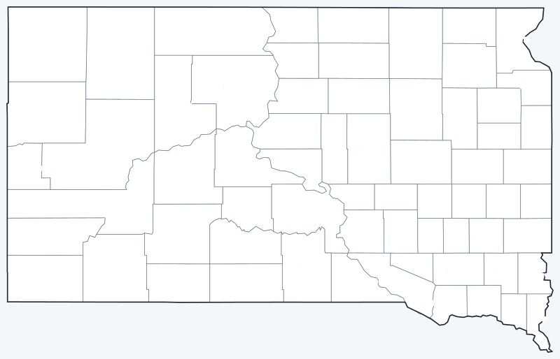
Download the labeled map with county names or the blank map with county lines only, free for personal and classroom use.
Frequently asked questions
How many counties are in South Dakota?
South Dakota has 66 counties. The most populous is Minnehaha County and the largest by land area is Meade County.
What is the largest county in South Dakota?
By land area, Meade County (3,470.9 sq mi, seat: Sturgis). By population, Minnehaha County, with 197,214 residents in 2020.
What county is Pierre in?
Pierre, the state capital, is the county seat of Hughes County.
What county is Sioux Falls in?
Most of Sioux Falls is in Minnehaha County, the most populous county in South Dakota; its southern part extends into Lincoln County.
More South Dakota maps
Back to the South Dakota state map with cities, highways and quick facts.
County maps of neighboring states: Iowa · Minnesota · Montana · Nebraska · North Dakota · Wyoming
Browse all 50 state maps.
Sources: U.S. Census Bureau (2020 Census, 2020 Gazetteer, boundaries); county seats from Wikipedia county lists cross-checked with Wikidata. Last reviewed October 2026.